More options for shoreline access at Lake Mead
As noted in my last column, I have recently received emails from readers inquiring about shoreline fishing opportunities at Lake Mead.
Unfortunately, despite having hundreds of miles of shoreline, Lake Mead offers only a handful of access points for shore anglers.
Last week I focused on access points located along Lakeshore Drive. Today I’ll focus on those areas accessible from Northshore Road.
The south end of Northshore Road intersects Lakeshore Drive just north of the fee station where Lake Mead Parkway enters the Lake Mead National Recreation Area from Henderson. Lake Mead Parkway becomes Lakeshore Drive once it enters the recreation area.
Though Northshore Road is accessible via Lake Mead Boulevard from the North Las Vegas side of the valley, the mileage references I use will begin from the intersection of Northshore Road and Lakeshore Drive.
Approximately 4¼ miles north of the intersection is the dirt access road to Gypsum Wash. Because of Lake Mead’s water level, Gypsum Wash won’t be of much use to most anglers today, but it won’t hurt to put this area on your list for future reference. Gypsum Wash can be productive for catfish and striped bass — all it needs is water.
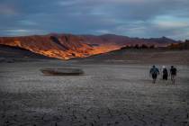
At about mile marker 5.5 is the road to Government Wash. Because there is a boat ramp, the road is paved about halfway to the water’s edge. The ramp has been out of water for several years, offering visitors little more than access to bathroom facilities. To reach the shoreline, anglers must traverse a bladed dirt road that divides into multiple smaller roads that follow different points out to the water.
The next access road leads to 8.0 Road Cove, so named because the road turns off Northshore Road at mile marker 8. Basically, 8.0 Road leads to the east side of Government Wash and divides into smaller roads that lead to various points at the water’s edge. This provides access to a lot of shoreline if you are willing to walk and try various spots.
Near mile marker 9 is the dirt road that leads to Crawdad Cove and Boxcar Cove. The road forks about a half-mile from the pavement with the left fork leading to Boxcar Cove and the right to Crawdad Cove. Though the main roads are bladed periodically, they can provide a rather rough ride during periods of high use. While this is no place for your vehicle, it is a good area for fishing from kayaks, canoes or float tubes.
Moving north, the next two access roads lead to the Callville Bay and Echo Bay marinas. Both roads are paved. While you can’t fish in the marina proper, you can fish those areas nearby. The Callville Bay road leaves Northshore Road at about mile marker 12. Echo Bay is another 25 miles up the road and can be easily accessed from Interstate 15 via Moapa Valley or Valley of Fire State Park.
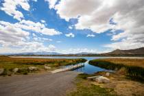
Approximately six miles north of the Echo Bay access road is Stewarts Point Road, which leads past some private homes to the Overton Arm of Lake Mead. As with some of the other areas I’ve mentioned, the main road divides into smaller roads that lead to various points, coves or places ideal for camping. Fishing for striped bass, catfish and even black bass can be good in the Stewarts Point area.
While four-wheel drive is not mandatory in the remote areas, it’s not a bad idea. The most important thing is to pay attention to the road details and be wary of sand and loose gravel.
Freelance writer Doug Nielsen is a conservation educator for the Nevada Department of Wildlife. His “In the Outdoors” column, published Thursday in the Las Vegas Review-Journal, is not affiliated with or endorsed by the NDOW. Any opinions he states in his column are his own. He can be reached at intheoutdoorslv@gmail.com.


