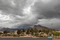
Las Vegas winds reach 67 mph, down southwest valley stoplight
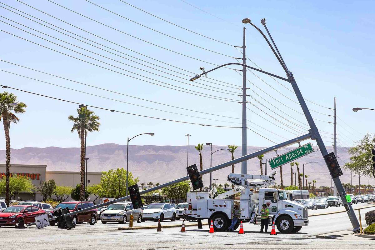

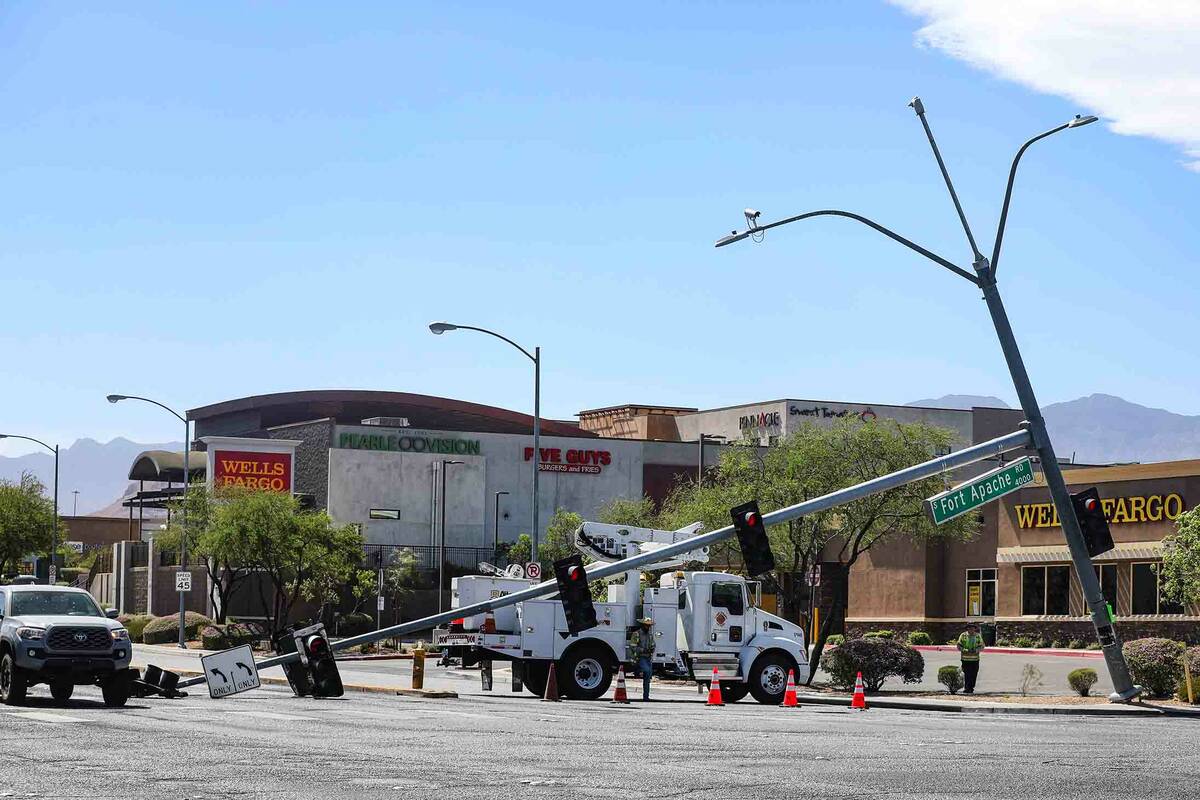
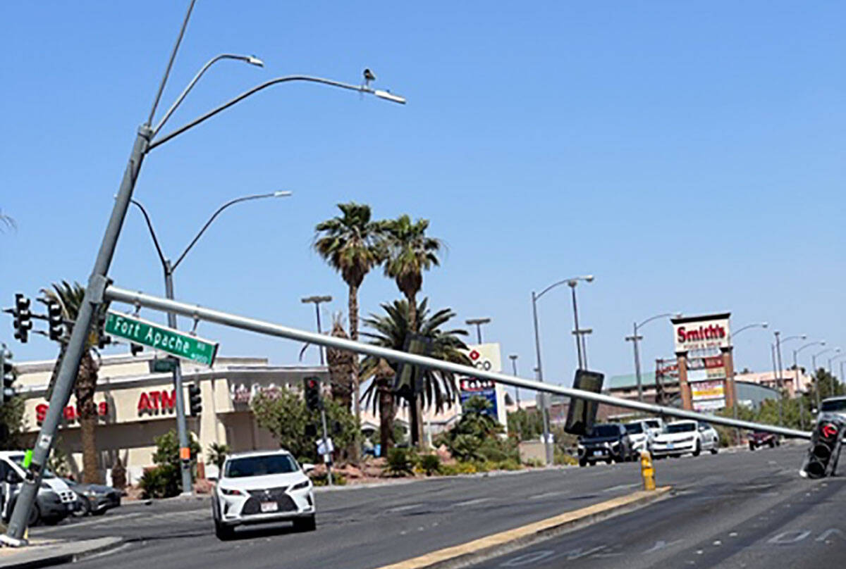

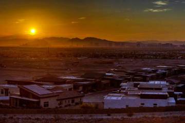

Winds gusting to 67 mph were hitting the Las Vegas Valley on Sunday afternoon, apparently causing a downed stoplight at a southwest valley intersection.
A traffic control signal at Fort Apache and Flamingo roads was down over the intersection with the lighting element on the pavement blocking a turn lane.
Metro Lt. Brian Boxler said the pole damage is not believed to have been caused by an accident. The westbound lanes of Flamingo were closed at Forth Apache as of 3:30 p.m.
A gust of 67 mph was reported about 6:34 p.m. at Red Rock National Conservation Area while Harry Reid International Airport was recording gusts between 26 and 40 mph from 11 a.m. with a gust of 46 mph about 5:40 p.m.
“The winds will be the strongest for the next couple of hours and overnight they should drop some,” said National Weather Service meteorologist Matt Woods.
A high wind advisory runs until 5 a.m. Monday for the valley with the heaviest winds — up to 50 mph — expected on the west side of the valley and in the Spring Mountains.
NV Energy said, “Our system is in good shape, and we haven’t experienced any significant outages due to the weather. We have not issued any calls for conservation.”
Wind velocities were decreasing a few hours after Sunday’s sunset.
Power cut to Kyle Canyon, Angel Peak
However, NV Energy cut power Sunday to Kyle Canyon and Angel Peak to reduce the rick of a fire that could be caused by electrical wires.
“This means that NV Energy will shut off power in one or more of its extreme or elevated fire-risk zones when certain environmental conditions are met and an evaluation of risk is done with guidance from local emergency management teams and other stakeholders,” the utility stated. “This helps prevent power lines, things that are blown into power lines, and other equipment from causing a wildfire.”
The event is scheduled to end about 9 a.m. Monday.
The utility has a customer resource center available at the Retreat on Charleston Peak on Sunday until 7 p.m. and on Monday from 8 a.m. to 7 p.m. or when power is restored.
The Sunday high reached 106 at the airport, several degrees short of the 112 record for June 12, set in 1940.
The @NWSCPC 6-10 day outlook is favoring well above normal precip. chances for all of AZ, with even some chances for southeast NV & far southeastern CA. The details around how much rain we could see and how long we could see it is still uncertain. Stay tuned! #NVwx #CAwx #AZwx pic.twitter.com/w08b4k2t0b
— NWS Las Vegas (@NWSVegas) June 12, 2022
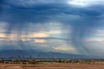
Patchy blowing dust after 2 p.m. is expected with similar conditions from 11 p.m. Sunday to 1 a.m. Monday.
A wind advisory covers the region from 11 a.m. until 8 p.m. Sunday with steady south-southwest winds gusting up to 40 to 50 mph.
A Monday morning low near 81 is forecast, rising to an afternoon high near 99. Wind gusts could reach 30 mph, according to the forecast.
A high of 97 is forecast for Tuesday before triple-digit highs resume on Wednesday.
A record high of 109 was reached at the airport on Friday while the Saturday high of 109 tied the existing record.
Contact Marvin Clemons at mclemons@reviewjournal.com. Follow @Marv_in_Vegas on Twitter.