Enjoy a few cooler days before a week of Las Vegas heat

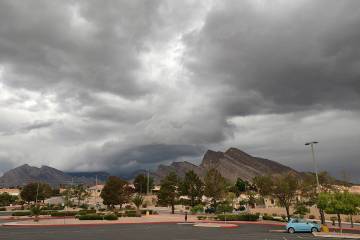


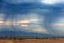
A low-pressure system will drop temperatures in the Las Vegas Valley on Wednesday and Thursday — before an anticipated long blast of heat.
“A cold front is pushing into the north part of the valley this morning,” National Weather Service meteorologist Barry Pierce said about 4:30 a.m. Wednesday. “Wind gusts will push up to 25 mph, but it will calm down in the afternoon.”
The forecast high is near 94 with an overnight low about 71.
Thursday should be similar with a high near 95 and north winds of 5 to 10 mph. The overnight low will be near 72.
Friday’s forecast high is 99 with 104 for Saturday and 107 on Sunday.
“There’s a good area of high pressure building over the weekend and into next week, and we’ll return to the 105-110 range,” Pierce said. “It might tail off the second half of next week, but it’s a little too early to tell right now.”
Contact Marvin Clemons at mclemons@reviewjournal.com. Follow @Marv_in_Vegas on Twitter.