Soak up stream’s beauty at Hackerry Canyon
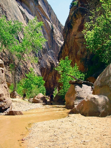
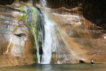
Hackberry Canyon is a hidden gem in the southwestern section of the 1.9 million-acre Grand Staircase-Escalante National Monument, Utah. It is a bit off the beaten path, but those who make the effort will be rewarded with a colorful narrow canyon complete with a perennial stream, flanked by lush vegetation.
It is often done as an easy day hike of about 1 or 2 miles upstream and returning. Some of the best scenery is in this part, but the more adventurous sometimes make it into an extended trek. The entire canyon runs more than 20 miles, and experienced technical climbers with a pick-up person can exit through a narrow slot canyon at Round Valley Draw.
The trailhead is at about 5,000 feet in elevation, so right now, and again in the fall, temperatures are likely to be ideal. From the parking area and trailhead, follow the well-worn path down about 30 yards into Cottonwood Wash and go right, then immediately head west, away from this wash and into the mouth of Hackberry Canyon.
Unless there has been a lot of rain recently, you will find the first quarter mile of the canyon dry. After this, you will find a narrow ribbon of water flowing down the drainage. At first, you will be able to avoid getting your feet wet, but eventually you will, although the canyon rarely has more than a couple of inches of water. Children will enjoy this hike for the first couple of miles as the traveling is easy along the sandy creek bottom.
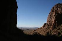
The narrow canyon walls consist of Navajo and Kayenta sandstone. In one area, they are only 20 feet apart yet tower above some 100 feet. For many, this will be the turning around point, but if you have the time, heading upstream is well worth it.
If you don’t mind some rock scrambling, one good destination is the Sam Pollock Arch in a side canyon. Look for the entrance to the canyon on your left about 2.75 miles from the trailhead. From the confluence of these two drainages, travel upstream about one-half mile, where you will find a dryfall that blocks all easy progress. Backtrack about 100 yards or so and head up on the right side of the canyon. This will get you up and around the dryfall, where you can easily drop back in the canyon. From here on up you will find that the hiking is easier. The arch will be on your right about one mile farther.
Be very careful where you step while in Hackberry Canyon, as there is fragile cryptobiotic soil everywhere. Just one footstep on this bumpy, crusty soil might take a century to repair itself.
The access road to this canyon, the gravel Cottonwood Road, is usually well-maintained and in good shape, but after heavy rains, it becomes impassable even in a four-wheel drive vehicle. Even in good, dry weather a high-clearance vehicle is needed. Be sure to inquire about up-to-date weather information at one of the monument’s visitor centers just before hitting the trail. When traveling from Las Vegas, you will be driving by the one in Kanab, which is at 745 E. Highway 89, open 8 a.m.-4:30 p.m. daily.
No permit is needed for day hiking in the canyon, but if you plan to do backpacking, you will need one. You can pick one up at the visitor center or self-permit at the trailhead register. Never enter this canyon if rain threatens because of the flash flood danger.
Deborah Wall is the author of “Great Hikes, A Cerca Country Guide” and “Base Camp Las Vegas: Hiking the Southwestern States,” published by Stephens Press. She can be reached at deborabus@aol.com.
DIRECTIONS TO HACKBERRY CANYONFrom Kanab, Utah take U.S. Highway 89 east for 37 miles and go left onto Cottonwood Canyon Road. Follow north for about 14.5 miles to an unsigned left for parking area and trailhead register.


