Need a drive? Check out these scenic byways around Las Vegas


Sick and tired of driving around town and seeing nothing but orange cones and torn-up streets? You might want to check out some of Southern Nevada’s scenic byways.
The Nevada Department of Transportation has designated five roads around Las Vegas as Nevada Scenic Byways. Here’s where you can find them:
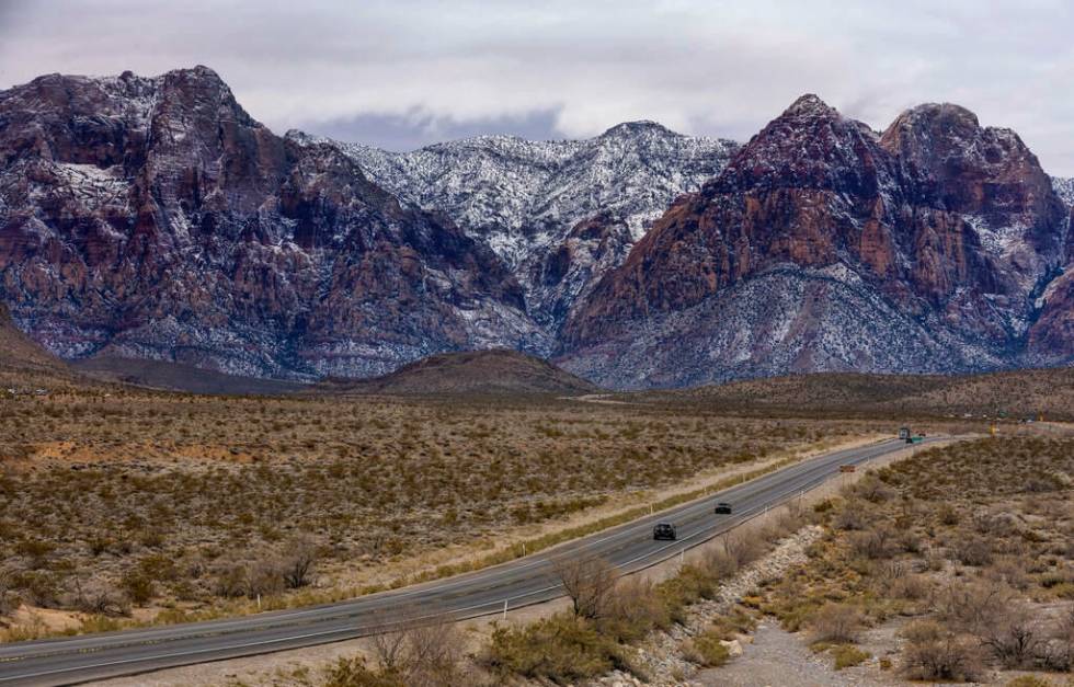
State Route 159: Red Rock Canyon Road
After driving west past Summerlin on Charleston Boulevard, the road becomes Red Rock Canyon Road — a two-lane route curving past Red Rock Canyon National Conservation Area’s Calico Tanks, the Rainbow Mountain Wilderness and finally past the small, unincorporated, former mining town of Blue Diamond until the road intersects with State Route 160, more commonly referred to as Blue Diamond Road.
While there is a fee to do the Red Rock Canyon Scenic Loop inside the conservation area, State Route 159 is free, and provides the same views of the beautiful mountains and Joshua trees in Red Rock Canyon as the loop — albeit from a slightly farther distance. (NDOT includes the scenic loop as part of Red Rock Canyon Road.)
The scenic route, which is 13 miles, requires a timed entry reservation from Oct. 1 through May 31, along with a $20 fee for cars or $10 for motorcycles. To make a reservation for the loop, visit recreation.gov.
The free-to-drive SR 159 takes you past some fee-free hiking trails in Red Rock Canyon, including the Kraft Mountain Loop, Middle Oak Creek, South Oak Creek and First Creek trails. Spring Mountain Ranch State Park is also just a turn off from the route and includes five trails to explore with an entry fee of $10 per vehicle for Nevada residents and $15 for non-Nevada vehicles.
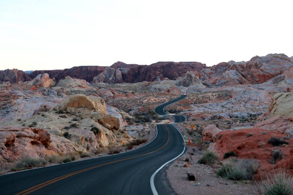
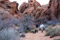
Valley of Fire Scenic Byway
Your GPS will call this route the Valley of Fire Highway. To get to the scenic portion of this road, take Interstate 15 north to Exit 75 and drive 25 miles to the West Entrance Station of Valley of Fire State Park. After paying the $10 Nevada resident vehicle fee (or the $15 non-resident vehicle fee), you’ll cruise on past bright orange sandstone mountains, beehive-shaped rocks and giant boulders.
At the end of the drive on the east side of the park outside of Overton, you’ll pass Elephant Rock, a prominent rock formation, to exit the park. From there, you can either drive north on Northshore Road into Moapa Valley or south into Lake Mead National Recreation Area, which also requires an entrance fee.
If you want to keep driving in the park, you can also turn onto Mouse’s Tank Road near the park’s visitor center that takes you past the pink and purple Pastel Canyon resembling a bowl of sherbert.
The road also leads to the trailheads of the Petroglyph Canyon trail and the Fire Wave trail. Visitors should check for seasonal closures of trails, as some close during summer months.
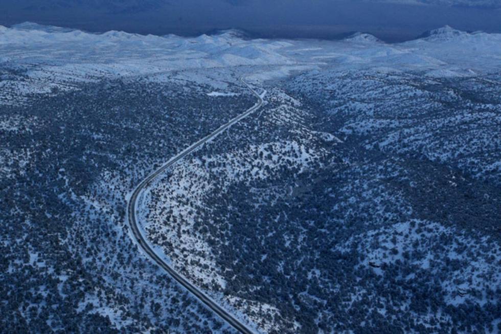
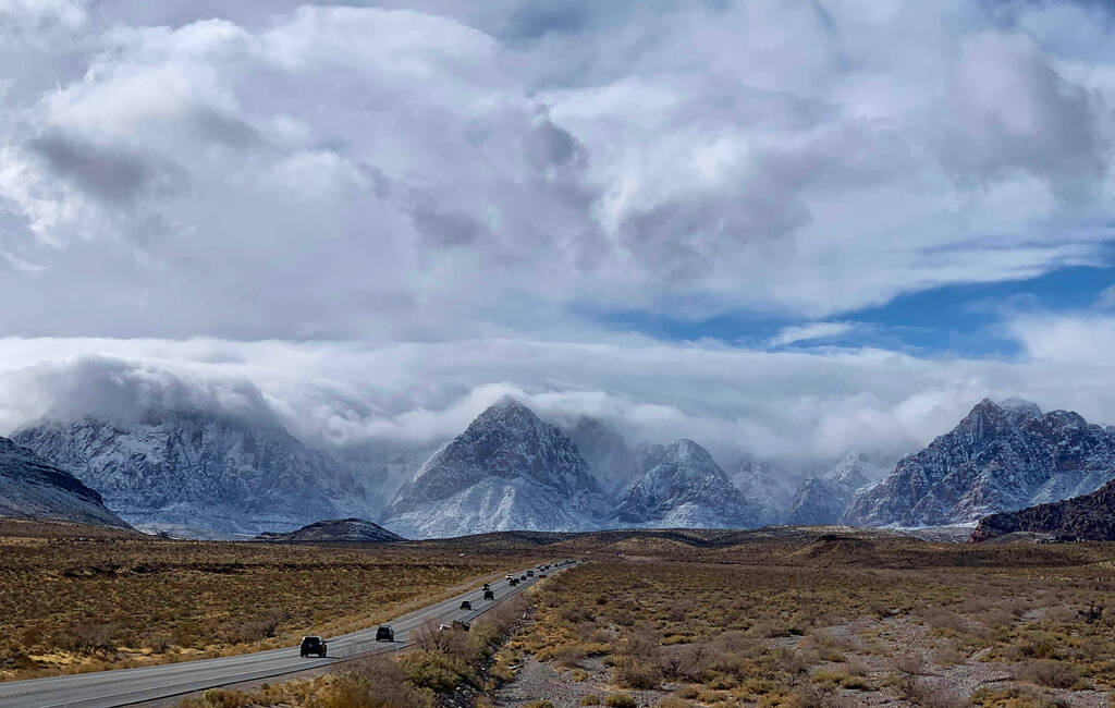
State Routes 156, 157 and 158: Mt Charleston Scenic Byway
Take U.S. Highway 95 north of the valley and exit on Kyle Canyon or Lee Canyon roads to get to this scenic route. This scenic byway passes through both Red Rock Canyon National Conservation Area and Spring Mountains National Conservation Area. Drivers can watch the desert landscape dotted in Joshua trees ends transition to a forest of juniper, ponderosa and pinyon pine trees.
The road gains approximately 4,000 feet of elevation from the Las Vegas Valley to the Spring Mountains Visitor Gateway. Watch the temperatures drop on your car thermometer as you ascend to the mountains. The mountains form a sky island with weather that differs from the hot, lower-elevation Mojave Desert.
The byway includes Lee Canyon, Kyle Canyon and Deer Creek roads, according to NDOT. Deer Creek Road connects Lee Canyon Road to Kyle Canyon Road, and is a great route for spotting wildflower fields in the spring.
Significant portions of the roads were destroyed from flooding after Tropical Storm Hilary dropped 8 inches of rain on the Spring Mountains in August. The roads are now open, but road work is ongoing.
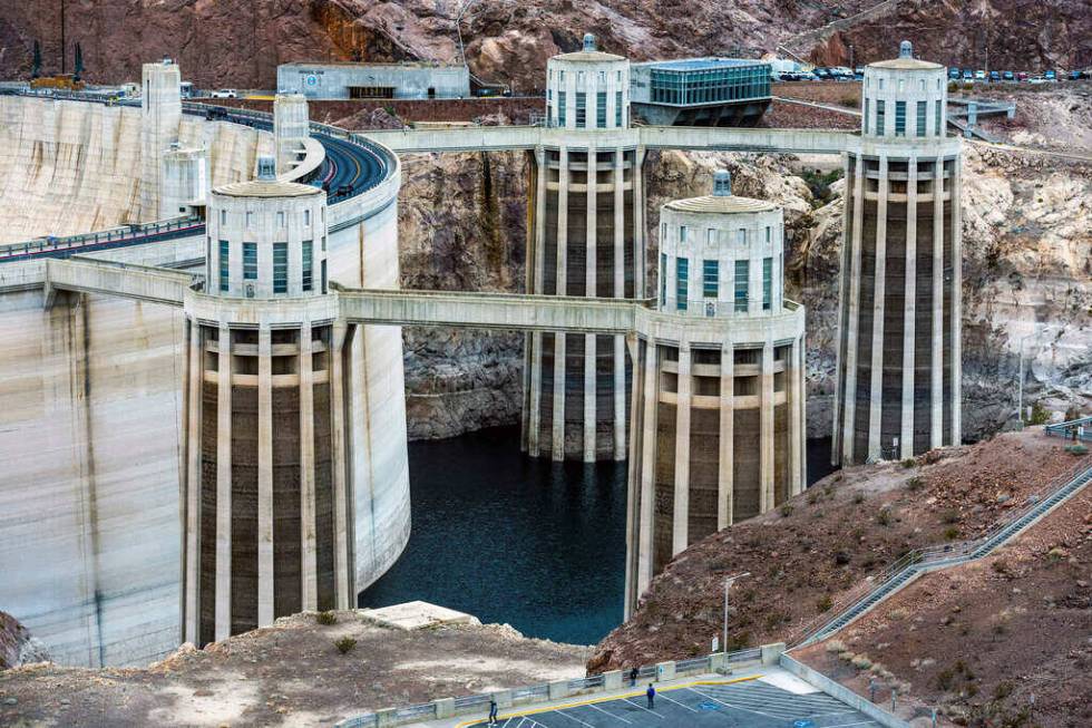
State Route 172: Hoover Dam Road
Hoover Dam Access Road (called Hoover Dam Road by NDOT) includes the original route for U.S. Highway 93 before the completion of the Mike O’Callaghan — Pat Tillman Memorial Bridge. The road takes travelers to the rim of the Hoover Dam, and provides a close look at the dam’s four large intake towers and access to the Hoover Dam Cafe.
The road also passes the parking lot that leads to the pedestrian path across the bridge.
On the other side of the Nevada-Arizona border, the road is called the Kingman Wash Access Road and reconnects to the main U.S. 93 route south toward Kingman, Arizona.

Las Vegas Strip
Not only is the Las Vegas Strip a Nevada scenic byway, it was also designated as the first (and only) “nighttime scenic byway” by the Federal Highway Commission in 1995, according to Travel Nevada.
The Federal Highway Administration states the National Scenic Byway route is 4.5 miles long and has “possibly the most concentrated collection of neon and lights in the world.”
Travel Nevada claims the route is lit by over 12 million light bulbs and provides “truly unparalleled people watching.”
Clark County defines the Las Vegas Strip as running between West Sahara Avenue (not including the Strat) and south to the “Welcome to Las Vegas” sign.
“A trip down the Strip is an all-inclusive way to experience the heart of Las Vegas — an adventure that captures 75 years of history, glitz, and roadside charm,” the FHA says.
Contact Taylor Lane at tlane@reviewjournal.com.