Utah’s Kolob Terrace boasts rugged beauty

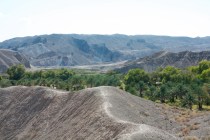
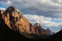
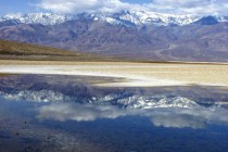
Southwestern Utah’s gorgeous Kolob Terrace sweeps from the 10,000-foot heights of the Markagunt Plateau to the cliff tops of Zion Canyon. It encompasses swaths of evergreen forests, stands of stately aspen, flower-strewn meadows, thickets of scrub oak and exposed sandstone benches. Access to this wild and rugged area is limited to a network of foot trails, a few primitive tracks and one improved route open after winter snows recede.
Follow Interstate 15 north into Utah. The scenic Kolob Terrace Road runs nearly 50 miles between state Route 14 east of Cedar City to the town of Virgin on state Route 9, the access road to Zion National Park. During summer, the route can be accessed from either end. Snows may force partial closure of the road from the north in autumn. The lower half of the route as far as Kolob Reservoir remains open longer to accommodate campers, hikers, horsemen, fishermen and hunters in season and winter snowmobilers.
The backcountry route is best driven in a vehicle with a little ground clearance. Pack extra water, road snacks, jackets and blankets for emergencies. Although many visitors tow trailers or drive RVs, there are length restrictions on some side roads, such as the one to Lava Point in Zion.
There are no services along the Kolob Terrace Road, so start with a full tank and carry a spare tire and the tools and expertise needed to change a flat. GPS systems may not work and cellphone service may be spotty. Equip yourself with a good, detailed highway map and more detailed sectional map, if you can locate one. Inquire at one of Utah’s travel information centers or at federal interagency visitor centers, such as the one near the Bluff Street exit off I-15 in St. George.
To reach the road from the north, follow I-15 to Cedar City, about 175 miles from Las Vegas. Exit I-15 and turn east at the Route 14 junction downtown to start up beautiful Cedar Canyon. Watch for the Kolob Terrace turnoff 13½ miles from the junction.
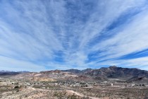
The road begins a series of swooping turns to climb out of the canyon. Panoramic views sweep over Cedar City into the Great Basin and the purple mountain ranges and distances of Nevada. The road climbs forested slopes with many fine homes on view lots. It tops out on the shoulders of 9,100-foot Lone Tree Mountain for the views over the Kolob Terrace. A rugged line of eroded pink cliffs marks distant Strawberry Point and other parts of the high plateau’s rim.
Tall quaking aspens contrast against dark evergreens and crowd up to the road. They promise gorgeous fall color displays, starting by late September. At lower elevations, oaks and vine maples carry the seasonal show. Miles of zigzag log fences delineate the road. Horses, cattle and sheep feed in wide meadows bright with summer wildflowers.
Kolob Reservoir attracts fly-fishermen vying for record trout. Despite limited development, the area attracts campers who must bring everything from home, including water. Dry conditions often dictate fire restrictions.
A smaller neighbor, Blue Springs Reservoir, lies a couple of miles south of Kolob Reservoir. Turn there on a dirt road to reach Lava Point with its overview of Zion’s upper canyons and its six-site primitive campground with no fees. Keep an eye on the skies, for this is an area with reported sightings of soaring California condors. The endangered birds are spreading out from transplant sites along the Colorado River east of the Grand Canyon — no great distance for the wide-winged condors.
South of the reservoirs, the road soon enters a spectacular region of colorful sandstone atop steep canyons cut by numerous small creeks. Often running close to the canyon rims, the road drops quickly from the cliff tops. It follows one of those creeks flowing toward the Virgin River to meet state Route 9 in the town of Virgin. Turn left to continue into the national park or right to return to I-15.


