Blythe Intaglios a mysterious part of desert Southwest
Those who poke around in the desert Southwest long enough encounter strange, mysterious and even inexplicable places. Such sites include the enormous figures created by people of ancient cultures living along the Colorado River near present-day Blythe, Calif. The artists of prehistory left behind rock art sites called geoglyphs or intaglios that lay undiscovered by non-natives until spotted from the air by a pilot in 1932.
The Blythe Intaglios (pronounced in-tal-yos) include three neighboring sites, each with a large human figure and two with a four-legged creature as well, thought to represent either a horse or a mountain lion. The largest human figure measures 171 feet in length, impossible to view in its entirety from the ground. Viewing from the air remains the best way to see the geoglyphs, creating popular scenic flights from Blythe and parasailing adventures over the figures.
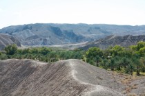
The geoglyphs sprawl over a barren area west of the Colorado River 15 miles north of Blythe off U.S. 95 about 180 miles south of Las Vegas. To reach the area, follow U.S. 95 from Las Vegas south over the California state line to Interstate 40. Head east to Needles and exit I-40 toward the Needles Airport to get onto U.S. 95 again.
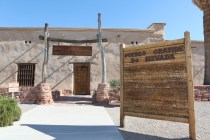
Follow U.S. 95 south toward Blythe about 78 miles. Watch for a side road on the right marked by a Bureau of Land Management sign. Turn off the highway and drive on the graded road a short distance to park near two adjacent groups of geoglyphs surrounded by fences. The third fenced area lies a short distance away, reached by a short hike. Because of damage years ago by off-road vandals, the BLM maintains barriers around these vulnerable cultural treasures, but the wheel tracks have scarcely faded in the decades since the fences were installed.
The best known and most accessible of this rare kind of prehistoric art in North America, the Blythe Intaglios number among just a few hundred examples thus far discovered in Southern California, Southwestern Arizona and Northern Mexico, mostly near the Colorado River. So important are these cultural remnants that they have been listed on the National Register of Historical Places since 1975. Other geoglyphs in the area include a figure dubbed “The Fisherman” south of Blythe, a huge snake near Yuma, Ariz., and the Topock Maze near Needles. Many others lie in secret, safely unmarked on public and private lands. Similar geoglyphs can be found elsewhere in the world, most notably in desert areas of Peru.
The ancient native people who created the intaglios deliberately selected desert terraces or low mesas where wind scours the landscape of sand and pebbles, leaving behind a fairly uniform natural mosaic of rocks known as “desert pavement.” Over time, the upper surfaces of the stone darken through exposure to manganese and other elements in the hot, dry air that produces “desert varnish,” a process scientists can measure to determine approximate age. Such measurements indicate the figures to be between 450 and 2,000 years old. If the animal figures are horses, the lower number is more likely, as horses are generally thought to have been reintroduced to this continent by the Spaniards.
To form the figures, the natives scraped the desert varnish to the edges of the figures, exposing the lighter-colored rock and sand beneath the desert pavement. They heaped the material pulled from the center around the edges, forming sunken designs called intaglios after an Italian form of engraving.
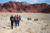
The rock art thus created involved a lot of preplanning and hard work. The figures had to mean something to them, perhaps for ceremonial purposes. Many experts assume that the huge figures stem from creation myths still honored by indigenous tribal groups along the Colorado such as the giant called Mastamho, the Creator and Hatakulva, a cougar that helped the Creator. Within sight of the enormous figures, remnants of an ancient footpath from the desert interior to the Pacific Coast indicate an active trade route in prehistory. Rock cairns along the trail near the geoglyphs arose as passing runners placed stones in their honor.
Modern times may further threaten the ancient sites. Proposed solar power generating fields nearby have stirred Native American groups to recent protest.
Margo Bartlett Pesek’s column appears on Sundays.


