Tired of scurrying from air-conditioned car to air-conditioned building? Time to head outward and upward for a hike far — but not too far — from the city sizzle of Las Vegas. Towering trees and cliffs translate into shade; driving distance delivers elevation. When you find the right combination of shade and elevation, temperatures drop by at least 20 degrees. Hiking opportunities are only 45 minutes away in the Spring Mountains National Recreation Area or two to four hours away in the mountains of Arizona or Utah.
1. Spring Mountains National Recreation Area
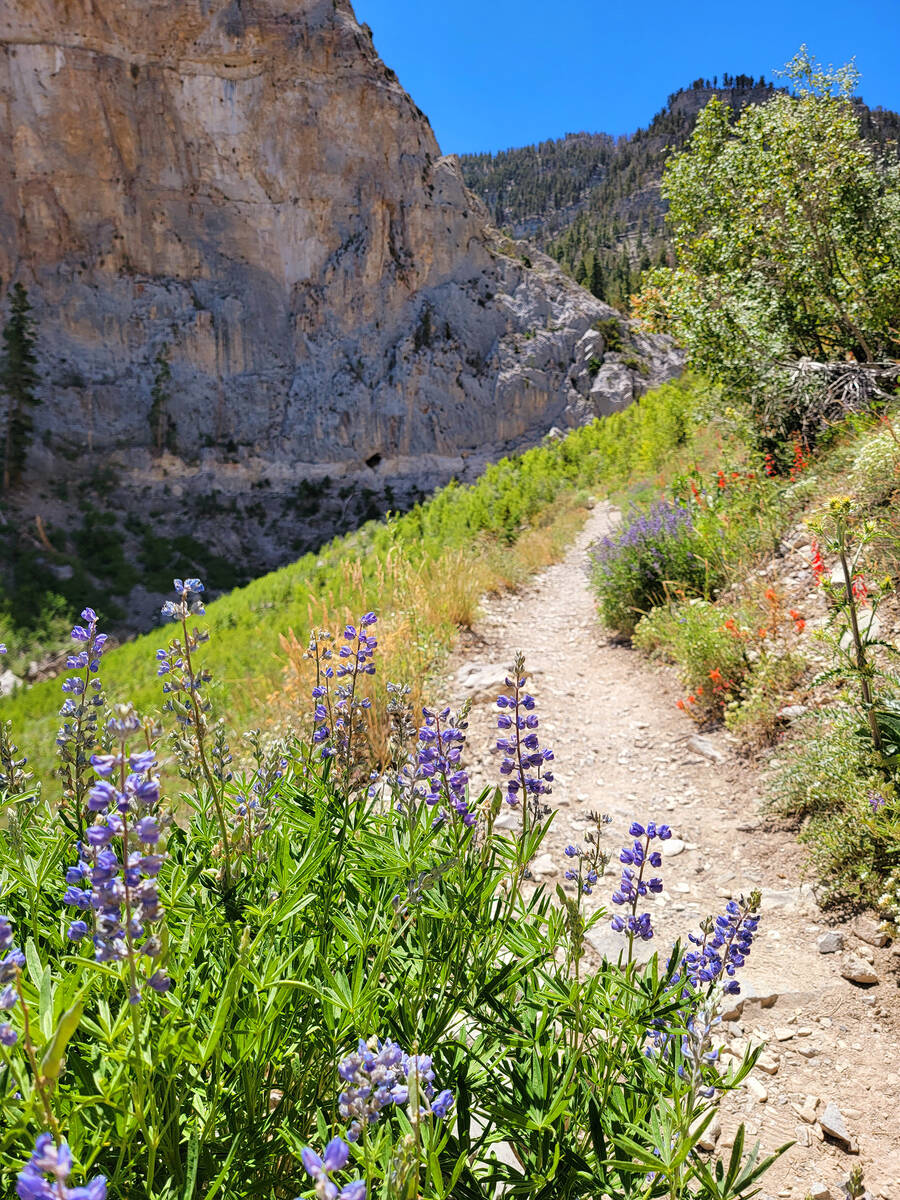
Our local treasureis better known by the name of its tallest peak, Mount Charleston. Hiking there comes in many forms, from short and simple to long and laborious. Stunning scenery, wildlife sightings and elegant wildflowers should be expected on trails and at picnic sites in both Kyle and Lee canyons.
Easy options include hiking Acastus Trail, strolling along Deer Creek and its picnic area or walking as far as you’d like on Lower Bristlecone Trail. Choosing such manageable treks doesn’t diminish the cooling effects of breaking away from the desert floor. These choices are ideal when kids and seniors are included on a day trip, allowing multiple generations to connect with nature at 8,000 feet in a forest of ponderosa pine, white fir and quaking aspen. 
More challenging hikes include the complete 6-mile Bristlecone Trail, which can be reached two ways starting at Lower or Upper Bristlecone trailheads. If hikers start at Lower Bristlecone trailhead, they will finish at Upper Bristlecone trailhead. Unless those completing the Bristlecone Trail have a second car parked near Lee Canyon ski resort, they’ll need to walk back down to their car at Lower Bristlecone parking lot. That’s a better option than starting at Upper Bristlecone and completing the hike only to face an upward hike back to the resort’s parking lot.
Alternatively, many hikers begin their journey at Upper Bristlecone trailhead and turn around only after spending time on an exposed ridge with spectacular mountain views and plenty of bristlecone pines, the tree species with the planet’s oldest recorded specimens. There, ancient bristlecone pines twist and tell tales of high-elevation survival on the rocky slopes they call home.
Another bristlecone hotspot is the North Loop trail, which has challenging out-and-back access to a bristlecone forest at about 9,300 feet. An ascent of another 700 feet in elevation via a series of brutal North Loop switchbacks will give hikers a chance to admire the legendary Raintree, a bristlecone with an estimated age of 3,000 years.
Many of Mount Charleston’s more challenging trails are found on the Kyle Canyon side. To counter crowded summer conditions, early morning arrival times mean more parking availability and the bonus of cooler temperatures.
Fletcher Canyon and Eagle’s Nest trails are two manageably challenging paths that yield wildlife and wildflower sightings. Elegant red-and-yellow columbines and soft pink Palmer’s penstemons grow against the towering gray walls of Fletcher Canyon, and Eagle’s Nest offers probable glimpses of broad-tailed hummingbirds and Woodhouse’s scrub-jays.
Some particularly challenging Mount Charleston hikes offer spectacular scenery and glimpses of butterflies, birds, ground squirrels, lizards, deer and wild horses. These include Trail Canyon (steady and strenuous elevation gain of 1,500 feet; 4.4-mile trip), Cathedral Rock (pleasant and straight-up elevation gain of nearly 1,000 feet; 2.8-mile trip), and South Loop (easier start but ascent becomes increasingly difficult; choose your own turnaround point on this lengthy trail).
2. Hualapai Mountain Park
This picturesque Arizona setting is a little more than two hours away, about 110 miles from Las Vegas and 14 miles southeast of Kingman, Arizona. Curvy Hualapai Mountain Road climbs to the Mohave County park’s entrance station, where visitors pay $10 to park and access the trails (don’t forget to ask for a map).
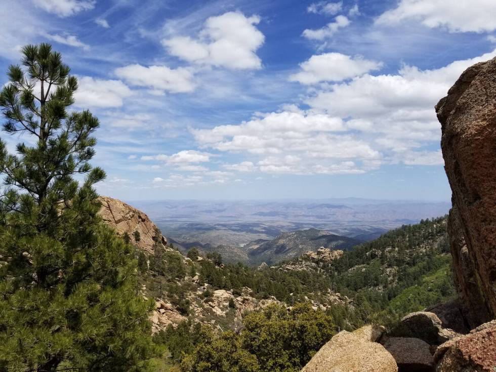
Potato Patch Loop, a moderately strenuous 4.4-mile loop, is a popular choice because of its giant granite boulders, critters, wildflowers and views of the surrounding Hualapai Mountains. 
First of all, don’t forget packing snacks and water into your backpacks. After parking, make your way toward a wooden sign that shows you have less than a mile to go along the Aspen Springs Trail before it meets up with Potato Patch Loop. More ambitious hiking options include ascending Aspen, Hayden or Hualapai peaks. Ten miles of trails wind through 2,300-acre Hualapai Mountain Park.
Within minutes of getting on the Potato Patch Loop, you might spot Arizona striped whiptail lizards and lupine flowers. Other lucky sightings might include deer foraging on mountain shrubbery, horned lizards, Gilbert’s skinks and an Abert’s squirrel, a large squirrel with elfin ears and a lengthy, fluffy tail.
Ultimately, Potato Patch Loop circles Aspen Peak, one of the park’s craggy summits above 8,000 feet. The trail has 6,000- and 7,000-foot elevations and continues through ponderosa and pinyon pines, juniper, Gambel oak, manzanita and cliffrose. A summer big-sky day might include unthreatening clouds floating above the Hualapai Mountains, which are named for “people of the tall pines” in the Hualapai language.
3. Cedar Breaks National Monument, South Rim Trail
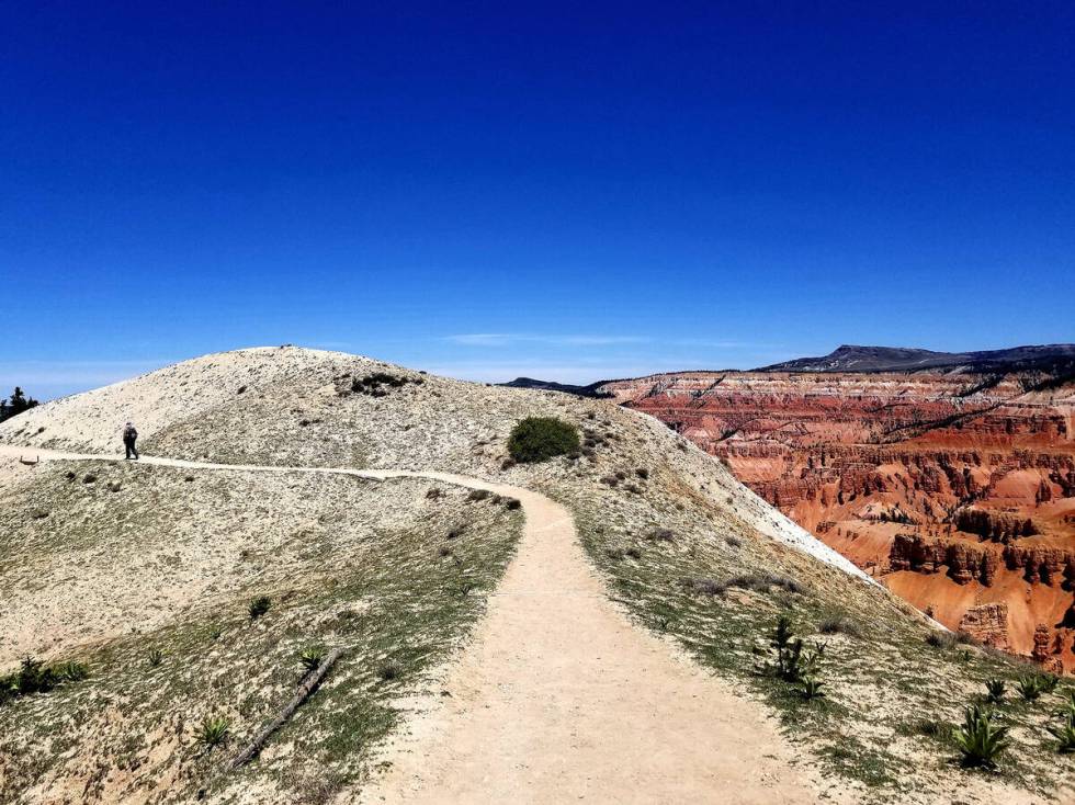
When a day trip has the potential to become an overnighter, consider the South Rim Trail at Cedar Breaks National Monument in Southern Utah. About 200 miles and four hours away from Las Vegas, this trail offers the finest way to appreciate a half-mile-deep geologic amphitheater with an eclectic assortment of red, orange, pink and white formations that include hoodoos, fins and arches. 
The trail, formerly called the Ramparts Trail, is reached after a 20-mile drive up scenic Highway 14 from Cedar City, an ideal base camp. This moderately strenuous out-and-back hike of 4 miles (an extra mile of hiking will add Bartzen Viewpoint) offers vistas of stunning geology while also affording close-up looks at flowers like cushion phlox clinging to life on the edge at a breathtaking elevation of 10,000 feet. Yellow-bellied marmots may be heard whistling from their precarious perches just above the amphitheater’s drop-offs. Bluebells, larkspurs and Indian paintbrush flowers add color to forested pockets. With their long tails and starlike flower faces, white Colorado columbines bloom along the trail, and potential bird sightings include mountain bluebirds, pine siskins and pine grosbeaks.
The South Rim Trail ascends and descends for the first mile before reaching Spectra Point, where the amphitheater’s beauty is on display. Even if you turn around at this spot, you’ll have enjoyed much of the trail’s wonder, including the monument’s gnarled and ancient bristlecone pines. But if you continue on, you’ll experience more of Cedar Breaks’ awe after enduring additional switchbacks, discovering more floral life and eventually looking over the amphitheater’s guard-railed Ramparts Viewpoint before returning to the parking lot.
The Point Supreme area of Cedar Breaks will remain closed for most of the summer, but the South Rim Trail and connected half of the parking lot will be open for hikers, according to the National Park Service. The other half of the parking lot, connected with the under-construction visitor center, will remain closed until the scheduled August 22 opening of the center. That date corresponds with the 90th anniversary of Cedar Breaks National Monument. ◆
For More Information Before You Hit the Trail …
Spring Mountains National Recreation Area:
Cedar Breaks National Monument
Click on "Things to do", "Activities" and "Hike a Trail" for information about South Rim Trail. Information about plants and animals found in Cedar Breaks may be found elsewhere on the website.


