Let it ride in Vegas – neighborhood biking and hiking trails


Many of Southern Nevada’s master-planned communities have extensive biking and hiking trails that weave through neighborhood parks, golf courses, recreational facilities and public common areas. The number of bicycle trails built in Las Vegas, North Las Vegas, Henderson and Boulder City over the past two decades has earned Southern Nevada a growing reputation as a bicycle-friendly region, with its ever-present renown as a worldwide mecca for resorts, gaming, dining, shopping and entertainment.
The city of Henderson was awarded a silver rating by the League of American Bicyclists for its community support, which includes 184 miles of dedicated bicycle trails. Henderson is the only city in Nevada to receive a silver award and one of just 75 cities nationwide.
Las Vegas qualified for a bronze rating by the same organization in 2014 and is one of just 271 American cities recognized at this level by the league.
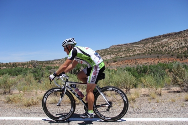
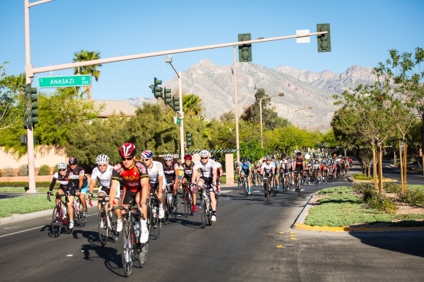
The Summerlin master-planned community, developed by The Howard Hughes Corp., has built an extensive trail system. The annual Tour de Summerlin invites bicyclists from all skill levels to explore these scenic avenues by choosing road race challenges of 40, 60 or 80 miles. Since the first event in 2002, participants have embraced the opportunity to push their athletic abilities as far as possible, while also raising money for local charities.
Skye Canyon is a new master-planned community being built with bicycle-friendly roadways in the northwest region of Las Vegas near Floyd Lamb Park at Tule Springs.
Chris Armstrong, vice president of Olympia Cos., has been an avid cyclist and sees the location near Horse Road and U.S. Highway 95 as a hub for bicycle access to Mount Charleston and the greater Las Vegas Valley.
“All of the arterial roads in Skye Canyon will have bicycle lanes on both sides of the streets with wide, detached sidewalks so that both slower cyclists and racing cyclists can use them,” Armstrong said.
He also noted the Nevada Department of Transportation has been widening Kyle Canyon Road, so there is now a bicycle lane that allows cyclists to travel from northwest Las Vegas to Mount Charleston, about 23 miles away. Residents will have access to the Vegas Valley Rim Trail bordering the Bruce Woodbury Parkway and all its connected bicycle pathways, including Red Rock Canyon National Park.
The first phase of new-home construction is underway at Skye Canyon, with the first 32 homes already sold and families beginning to move in. Builders include Woodside Homes, Pulte Homes and Century Communities. When fully completed in seven to 10 years, the Skye Canyon community will envelop 1,700 acres with 9,000 new homes, integrated with neighborhood parks, retail space and a local resort.
The new Cadence master-planned community by Landwell Co. in Henderson will encompass 2,200 acres with 13,250 homes, 1.1 million square feet of retail space and a 1,500-room resort when fully built out near Boulder Highway over the next decade. New homes will be built by Ryland Homes, Woodside Homes and Lennar’s age-qualified community.
During the first phase of development, the Cadence master plan has included a bike sharing program along its expanse of trails, where hikers can check out a bicycle from a cellphone app when needed.
The presence of bicycle trails near the Strip and Downtown casinos surprises many new visitors.
Thanks to the efforts of the Regional Transportation Commission, bicycle lanes have always been part of planning efforts to develop “complete streets” in urban areas like Downtown Las Vegas that include multiple modes of transportation.
Mauricia Baca is the executive director of the Outside Las Vegas Foundation. She wants to connect all of these communities together through the Vegas Valley Rim Trail project, an ambitious effort to build bicycling and hiking trails that will parallel the 215 Beltway encircling the Las Vegas Valley.
“Our valley is evolving beyond sustainability into a more vibrant community,” Baca said. “Bicycle trail building efforts actually began in 1998 with funding from the Southern Nevada Public Land Management Act.”
That federal law allowed the Bureau of Land Management to sell public lands near Las Vegas and share the revenue with Nevada’s General Education Fund, the Southern Nevada Water Authority and a special fund under the U.S. secretary of the Interior that was dedicated to Nevada capital improvements for parks, trails, natural conservation areas, wildfire prevention and statewide restoration projects.
A Southern Nevada Regional Planning Coalition was formed to look at ways to use funding from the Bureau of Land Management to help develop the region. By 2008, the Regional Open Space and Trails Work Group formed to help administer and organize the growing expanse of trail systems.
The River Mountains Loop Trail project was the first major effort by this group and is a predecessor to the Vegas Valley Rim Trail project. The loop trail stretches more than 35 miles around the River Mountains, as it parallels Lakeshore Road along Lake Mead, then circles through Boulder City and back north through eastern Henderson.
With BLM funding, the project also drew support from the Southern Nevada Water Authority, Southwest Gas, local municipalities and other civic organizations from 1998 until it was completed in 2011.
The Vegas Valley Rim Trail project will knit together local community trails with larger systems, like the 13-mile Lower Las Vegas Wash Trail in North Las Vegas, through the addition of connecting regional infrastructure over the next decade.
There are also many active events and road races each year in the Las Vegas Valley, sponsored by local bicycle shops such as Las Vegas Cyclery/Escape Adventures and McGhie’s Ski, Bike and Board.
The Interbike tradeshow convenes every September at the Mandalay Bay Convention Center on the Strip. International bicycle dealerships gather at this conference and expo to stage multiple events throughout Southern Nevada during that time, including mountain biking time trials near Boulder City and Lake Mead.
Find a trail in your neighborhood
1. A good place to start researching bicycle and hiking trail maps is at this Regional Transportation Commission webpage: www.rtcsnv.com/cycling/bike-route-trails-map.
2. Google Maps are also a great way to find bicycle trails. They can be selected as overlays from either standard maps or satellite views. When accessing a Google map, click on the icon that has three horizontal lines in the top left corner of the screen to reveal a pull-down menu that includes a “Bicycling” category. Click on the “Bicycling” selection to reveal color-coded overlays on the map in standard or satellite view. Included are Trails, Dedicated Lanes, Bicycle-Friendly Roads and Dirt/Unpaved Trails.
3. The Outside Las Vegas Foundation features an interactive map that lets you choose overlays for bicycle information and trail systems that run through local neighborhoods and also connect to major roadways: www.outsidelasvegas.org/trail-search
.
4. The Southern Nevada Health District hosts a trail-finder website and mobile phone app called Neon to Nature, which rates each trail as easy, moderate, hard or strenuous at<href="http://www.gethealthyclarkcounty.org/neon2nature/index.php" www.gethealthyclarkcounty.org/neon2nature/index.php.


