Travel bans in place through Northeast as storm approaches

The first major snowstorm of 2015 is expected to hit the Northeastern United States on Monday and Tuesday.
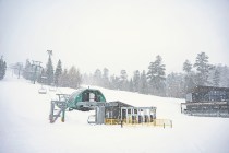
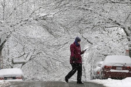
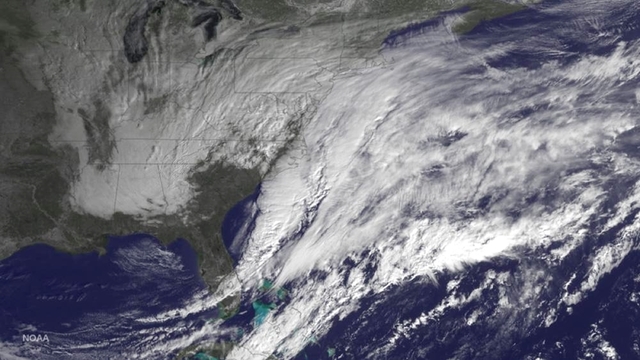
The National Weather Service describes the storm as a “crippling and potentially historic blizzard” that could bring up to 3 feet of snow, heavy winds, widespread power outages and epic travel difficulties.
Airlines canceled thousands of flights, and government officials across the Northeast urged residents to take heed of the weather warnings and prepare for the storm.
Here’s what’s expected across the region:
New York officials gave a timeline for residents to get home from work ahead of the storm: Subway service will begin to be limited, beginning around 7 p.m. ET, and a travel ban on all roads is possible after 11 p.m., Gov. Andrew Cuomo said.
Snow will remain light through Monday evening rush hour.
The heaviest snow is likely to fall between 7 p.m. Monday and noon Tuesday, with more than 2 feet possible by Wednesday morning, the National Weather Service said
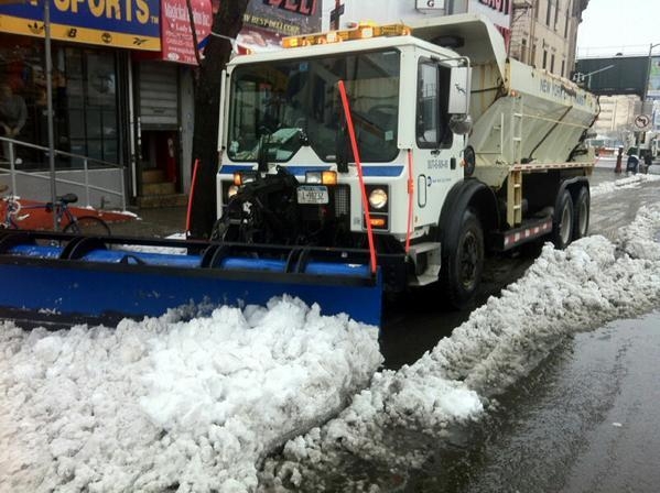
The state Department of Transportation warned of travel disruptions and urged people to stay home. The department said it had moved extra equipment downstate to deal with the impending storm.
New York Mayor Bill de Blasio was briefing reporters around midday Monday.
New York City Public Schools are open Monday, but after-school activities are canceled because of the blizzard. Schools are probably closed Tuesday.
City officials restricted parking, suspended garbage collection and told residents to avoid city parks. Falling tree branches could be dangerous, they said.
Getting around the city will be tough Tuesday, too.
“Tomorrow will be an extremely difficult day,” Metropolitan Transportation Authority Chairman Tom Prendergast said.
Connecticut Gov. Dannel Malloy signed an order banning travel after 9 p.m. Monday and said motorists should avoid travel for the duration of the storm.
“It is imperative that you have a plan in place to get home safely this evening before the heavy snow begins and stay there for the duration of the storm,” he said.
As many as 120,000 households could lose power and in all likelihood could be without power for several days, he said.
The state’s Emergency Operations Center will be activated at 4 p.m., according to the governor’s office.
Snow will remain light into the evening, with the heaviest likely between 4 a.m. Tuesday and early Tuesday evening.
During that time, winds will gust to 50-plus mph, perhaps 70-plus along the Cape.
Massachusetts Gov. Charlie Baker called the situation “an historic, top-five storm.”
“Driving will be virtually impossible in many areas for extended periods of time,” he said.
Boston public schools are open Monday, but Mayor Marty Walsh said they will close Tuesday.
Power could be out to thousands for days, officials say.
Despite the blizzard threat, a send-off celebration for the Super Bowl-bound New England Patriots scheduled Monday at Boston City Hall Plaza should go off without problems, Walsh says.
There will be light snow during the day Monday, with the storm intensifying from overnight to midday Tuesday.
Philadelphia public schools will dismiss students at noon Monday.
The state Department of Transportation urged motorists to postpone travel where possible.
New Jersey Gov. Chris Christie declared a state of emergency Monday.
He said crews are standing by to man 3,700 trucks to salt New Jersey roads and highways.
He said many schools will likely close early Monday and be closed Tuesday.
Transit systems will likely begin to shut down Monday around 10 p.m. and will likely not be available Tuesday, he said.
“If you do not have to drive, please stay home and stay off the roads,” he said.