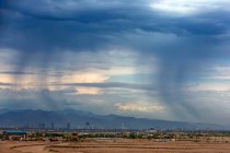
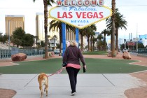
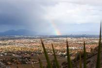
Las Vegas Valley soon might see some isolated thunderstorms


Seasonally cool temperatures will remain in the Las Vegas Valley before next week’s isolated thunderstorms begin, according to officials at the National Weather Service.
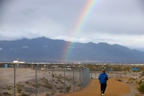
Storm clouds may be visible south of the valley Monday, but Barry Pierce, a meteorologist at the National Weather Service, said residents shouldn’t expect any isolated thunderstorms until Tuesday afternoon.
“Tuesday and Wednesday we’re looking a little bit better in confidence that we finally get something into the valley. It’s taking its sweet time,” Pierce said.
Meteorologist John Adair said there will be a 20 percent chance for thunderstorm activity during the afternoons from Tuesday to Thursday.
“The pattern that we have bringing the moisture in is pretty typical of monsoon patterns,” he said.
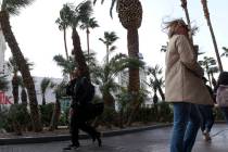
After Saturday’s high of 105 degrees, temperatures are expected to climb again before dropping with potential thunderstorm activity. Sunday should see a high of 106, followed by 108 on Monday, 104 on Tuesday, 102 on Wednesday and 104 on Thursday, the weather service said.
Overnight lows will stay in the low- to mid-80s.
Pierce also warned the weather service may send out alerts regarding dry lightning, but nothing is set in stone yet.
“If you happen to have cloud-to-ground lightning strikes and it happens to hit a tree or vegetation, it could ignite that plant on fire, and the winds that come from the storm could help start carrying the fire,” Pierce explained.
Contact Sabrina Schnur at sschnur@reviewjournal.com or 702-383-0278. Follow @sabrina_schnur on Twitter. Review-Journal staff writer Katelyn Newberg contributed to this report.