Bills in Congress could improve digital mapping for hunters


In recent months, the importance of digital technology in our lives has become quite apparent, probably more so now than ever before.
Internet purchases have expanded well beyond seasonal gifts to include groceries and household items we use daily, and children across the country are attending school online.
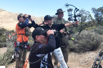
Technology also is playing a larger role in our favorite outdoor pastimes. We capture video of our exploits through small action cameras, modern rifle scopes calculate distance and automatically adjust for wind, cellphone apps give us up-to-the-minute weather reports for specific places and trail cameras capture images of animal and human activity in remote places.
As is always the case with new stuff, technology has its upsides and its downsides, its supporters and its detractors. However, one aspect of technology that seems to have universal support is digital mapping. As good as it is now, digital mapping may get even better, especially for outdoor enthusiasts looking to access public lands, if a matching pair of bills get the nod from Congress.
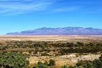
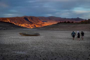
Though I still prefer paper maps when in the field, I do have a growing appreciation for digital mapping technology and its associated applications. That stems from an experience while scouting for a bighorn sheep hunt in 2018.
At one point, I stood with one foot within the boundaries of Valley of Fire State Park and the other on public land where hunting is permitted. The only way I could determine that level of detail was with a mapping application called onX Hunt. Through that app I also was able to identify privately owned parcels in my unit complete with ownership information.
Do that with a paper map.
As technology has improved, so too has the capability of companies like onX to identify even the smallest parcels of public land. As those parcels have been identified, however, so too has the challenge of public access to those parcels landlocked by privately owned lands.
In 2018, the folks at onX and the Theodore Roosevelt Conservation Partnership (TRCP) teamed up to identify the scope of the problem.
Since that time, they have identified 16.25 million acres of state and federally managed lands that are landlocked by private property; 15.87 million of those acres are here in the West. And more than 2 million of those are federally managed lands in Nevada, lands managed by the Bureau of Land Management, U.S. Forest Service and other agencies.
Most of that acreage is inaccessible due to a lack of access roads or trails, and according to the TRCP, “Each inaccessible acre represents lost outdoor recreation opportunities …”
“They belong to all of us, but you can’t get to them without permission from a private landowner,” notes the TRCP website. “In addition to island-like isolated parcels that are entirely surrounded by private holdings, the West’s unique history has created many checkerboard lands where ‘corner crossing’ is not considered a legal form of access from public to private land — even where they are steps apart.”
Perhaps the solution to the challenge of public lands access can be found by combining today’s mapping technology with an update in America’s mapping data that would be mandated and funded by the bipartisan Modernizing Access to our Public Land Act. Introduced in the Senate and the House of Representatives, the MAPLand Act directs federal land management agencies to create compatible outdoor recreation databases. That information would then be digitized and made available to the public as geographic information system (GIS) files that can be used in mapping apps.
In other words, you could have available in your phone such information as easements and rights-of-way in private land, the open or closed status of roads and trails, seasonal road or trail closures, types of vehicles allowed and where, boundaries of areas where hunting or recreational shooting is regulated or closed, and areas on public waters where watercraft access is prohibited or horsepower is restricted.
Waterfowl season opens
For those of you who have been waiting since last winter for waterfowl season to begin, your wait is nearly over. The earliest opening day of Nevada’s 2020 waterfowl season is Saturday in the state’s Northeast Zone, which is made up of Elko and White Pine counties. The Northwest Zone follows on Oct. 10 and the South Zone, except Moapa Valley, opens Oct. 17.
Freelance writer Doug Nielsen is a conservation educator for the Nevada Department of Wildlife. His “In the Outdoors” column is not affiliated with or endorsed by the NDOW. Any opinions he states in his column are his own. Find him on Facebook at @dougwritesoutdoors. He can be reached at intheoutdoorslv@gmail.com