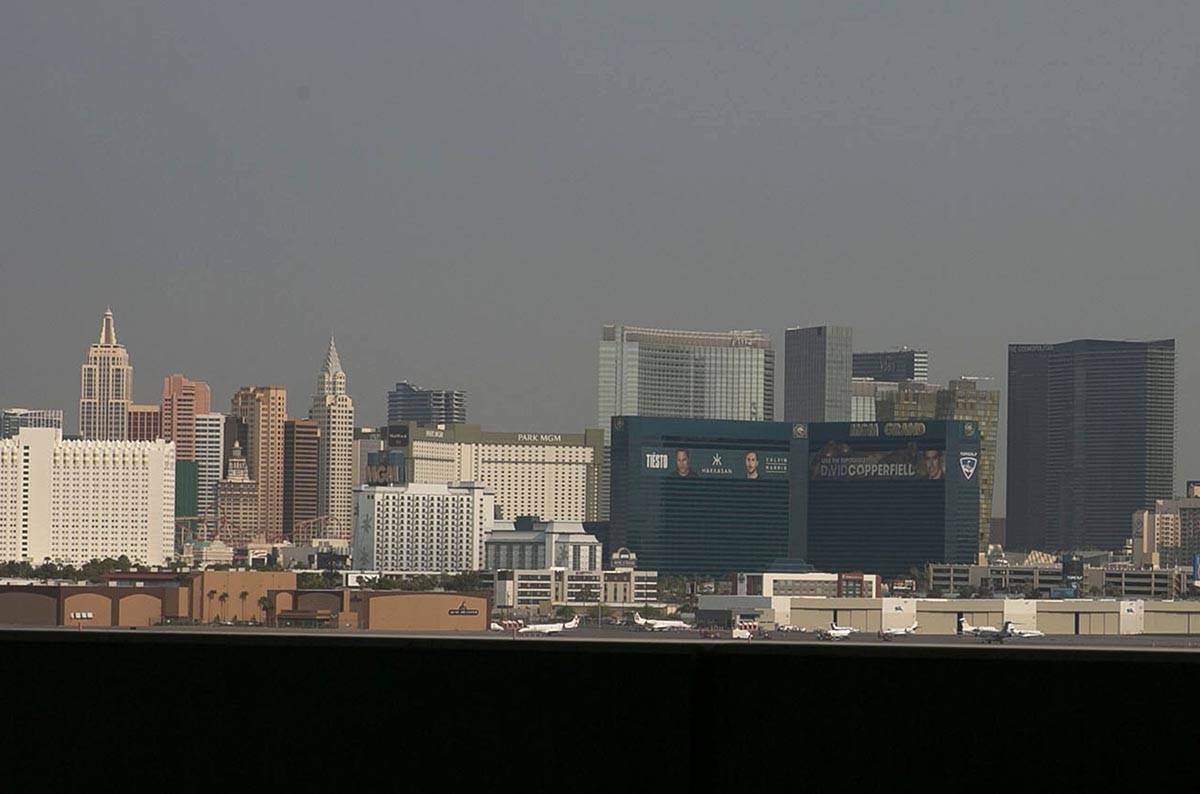
Smoke blots out Las Vegas sunrise; air advisory issued through weekend

Shortly after sunrise, the sun was not visible in the Las Vegas sky because of extreme haze, smoke and ozone.
Because of wildfires all over the West, the potentially hazardous conditions may continue for an unknown period of time, according to the National Weather Service.
“It is just all the smoke” covering up the sun, meteorologist Clay Morgan said. “There is no liquid or ice crystals or water clouds.
“I’m not sure that any of this will flush out during the day,” Morgan said. “It will probably get a little better, but not much. It’s just a ridiculous amount of smoke over such a wide area.”
Due to the smoke, @SustainClarkCty has issued a #SmokeOzoneAdvisory. 🌫️
Want an air quality forecast? Here is their forecast page: ⬇️https://t.co/KCgjbWuEb7
— NWS Las Vegas (@NWSVegas) August 21, 2020
The Clark County Department of Air Quality issued an air quality advisory through Sunday, saying effects of smoke from regional wildfires will put ozone quality in the Unhealthy for Sensitive Groups (USG) level and the air quality index will be moderate for particulates.
“While a return to breezy southwesterly afternoon winds will improve valley ventilation, we are continuing to monitor the fires causing the smoke impacts,” the advisory stated.
Smoke is made of small particles and other pollutants that can aggravate respiratory diseases andcontribute to ground-level ozone formation. Exposure to ozone can induce coughing, wheezing and shortness of breath even in healthy people. A seasonal ozone advisory is in effect.
350-plus fires in California
More than 350 fires are burning in California, and the air quality in the state is currently the worst on Earth.
“It all depends on the direction of the wind and the progress of the firefighters,” Morgan said. “For now, we have to take it day by day.”
The haze may lower the Friday high temperature, expected to be 111. If reached, that would be a degree above the record for Aug. 21, set in 2009.
The high Thursday was 112, topping the 110 set in 1950. It was the 50th straight day with a high of 100 or more. The record is 66 days, set in 1944. It also was the seventh day with a high of 110 or higher. The record is 10 consecutive days in 1961.
The morning low was 88 just before 6 a.m. Friday and rose to 98 just before 11 a.m.
Boy, has it been hot!! 🥵
AS IT STANDS, August 2020 is the hottest August on record for #LasVegas with an average temp (high & low) of 95.5F.
We still have 12 more full days left of August 2020, but it's looking on par to break the record.
🌡️♨️#VegasWxRecords #ItIsHOT https://t.co/1KpjRqdd2n— NWS Las Vegas (@NWSVegas) August 20, 2020
Through Thursday, the average August temperature at McCarran International Airport is 95.7 degrees. That’s the daily highs and lows averaged out. The record for August is 94.4, set in 2018.
A weather service tweet said the average was 95.5 as of Thursday, but that has risen.
Chance of rain
A 20 percent chance of rain is in the forecast for Saturday, when the high temperature is expected to be around 109.
“It could happen in any of the higher elevations around the valley, but most likely around the west and south side,” Morgan said.
Sunday has a forecast high of 108.
Contact Marvin Clemons at mclemons@reviewjournal.com. Follow @Marv_in_Vegas on Twitter.