Trailhead between Las Vegas, Pahrump offers easy hikes, grand payoffs

Searching for a brilliant new spot to add to your 2022 list of outdoor escapes? Southern Nevadans already have plenty of winter hiking choices with Red Rock Canyon, Valley of Fire, Sloan Canyon and Lake Mead National Recreation Area. An excellent addition, especially on a sunny day, would be Late Night Trailhead, where manageable and meandering trails sprawl into the Las Vegas outback.
A half-day is well spent on a walkabout through this area just off state Route 160, the highway that leads to Pahrump from Las Vegas, also known as Blue Diamond Road. The Late Night Trailhead and parking area are 4½ miles past the turnoff to Red Rock/state Route 159. Late Night Trailhead is marked by a rustic metal sculpture of a cowboy and a couple of burros on the side of the highway.
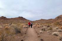
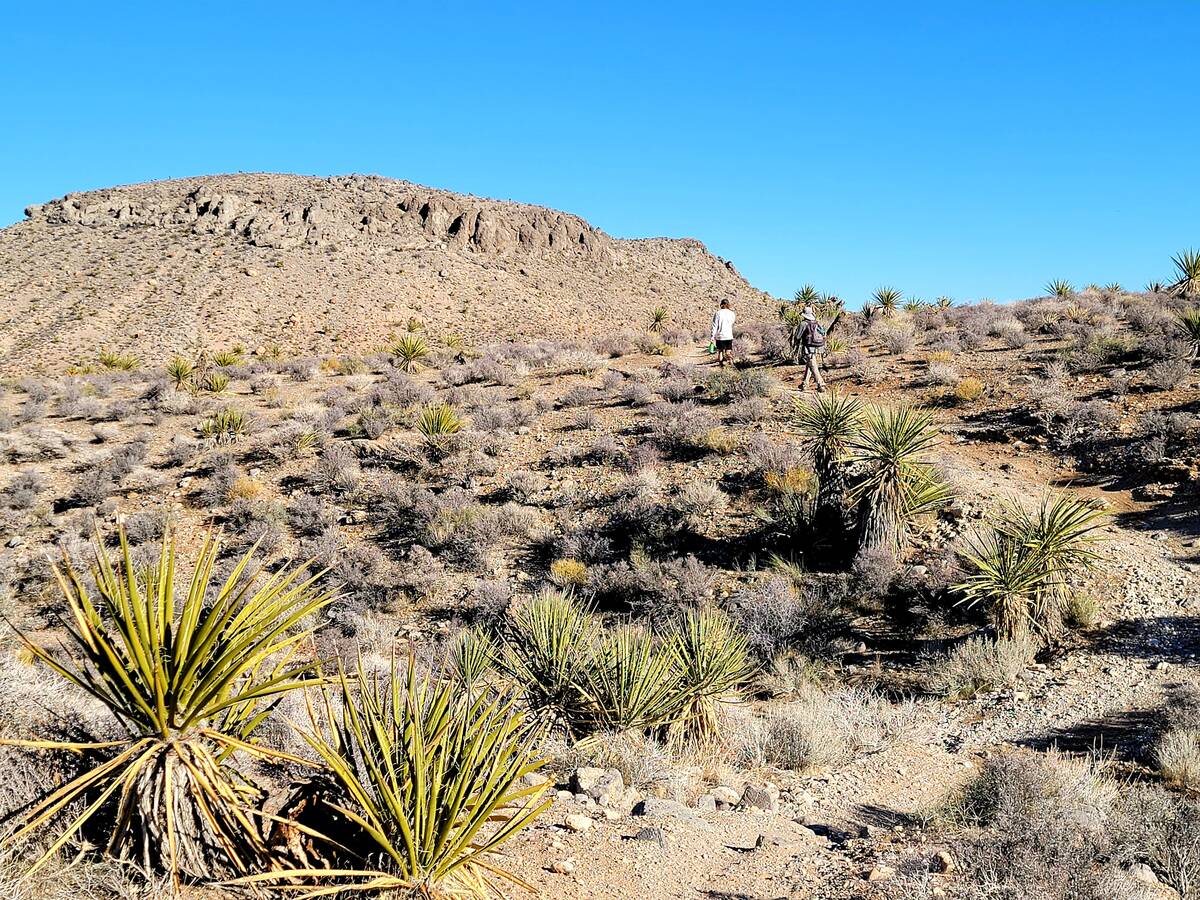
After parking your car and safely locking the tensions of the daily rat race inside, you will find quiet and relatively flat trails winding through a Mojave Desert scrubland that’s home to some of the most awkwardly handsome Joshua trees in Southern Nevada. You might hear ladder-backed woodpeckers and see — but hopefully not step in — wild burro scat. Adventuring begins on either side of the parking lot’s latrines, and it’s best to not expect much trail guidance or many wayfinding signs. A sense of adventure and plenty of hiking sensibility are what’s needed.
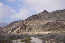
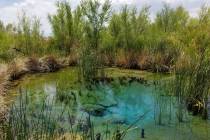
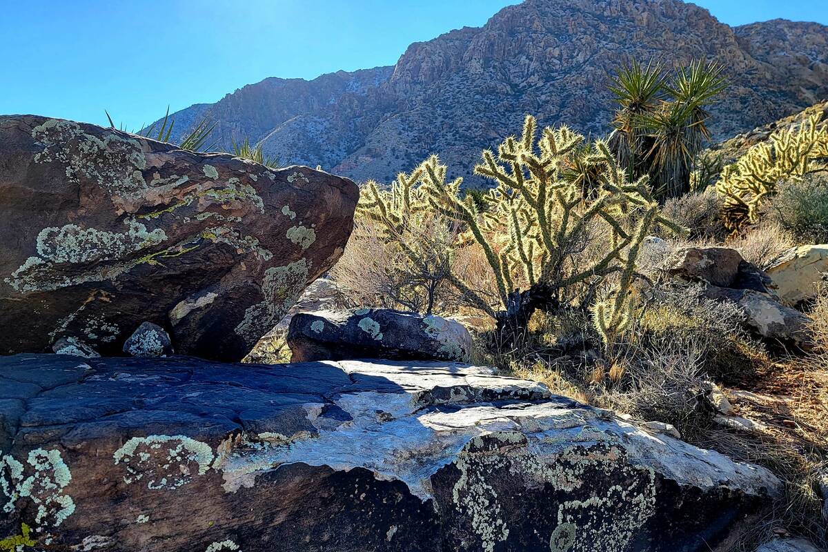
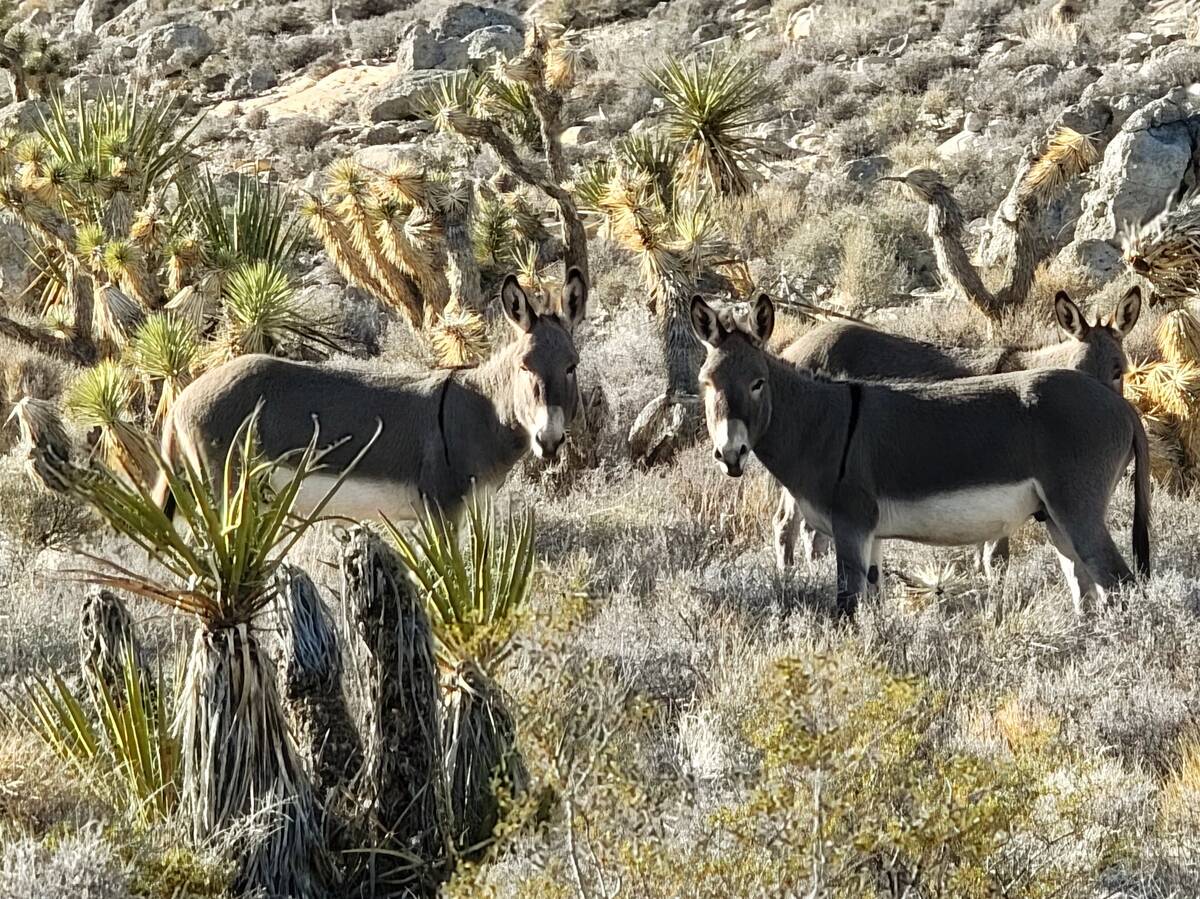
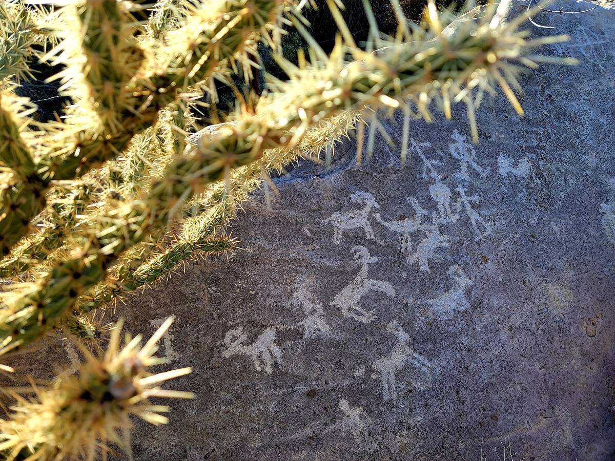
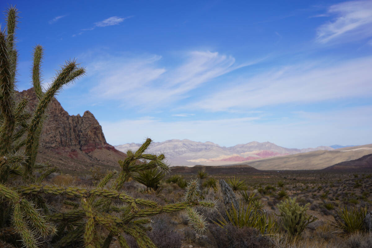
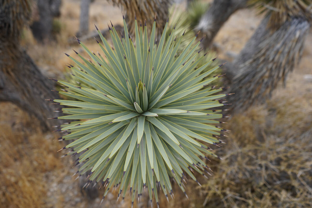
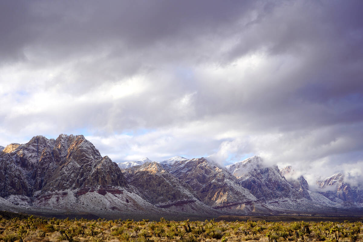
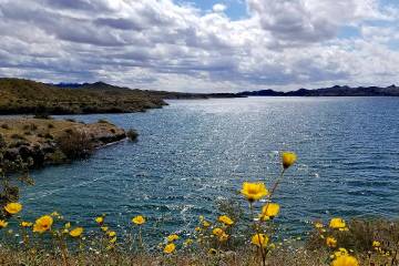
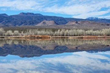
The payoffs can be grand. Bright blue skies contrasting a muted tapestry of desert beige, gray and sage green. Outstanding perspectives to watch clouds build dramatically. Giant reddish-brown conglomerate boulders that spark geologic curiosity about a time when ancient seas covered the landscape. Sunshine spinning gold through sheaths of the spines of thousands of buckhorn chollas. Sweeping views that include miles of towering sandstone cliffs and the Calico Hills far to the north, along Red Rock’s scenic loop. Petroglyphs of bighorn sheep near Lone Grapevine Spring. A chance to walk in a vast garden of hardy plants armed with spikes, spines and swords (Joshua trees, Mojave yuccas, buckhorn and pencil chollas and barrel and hedgehog cactus). A lucky trailside encounter with grazing wild burros. Spotting a boisterous flock of pinyon jays on a cool day. Clumps of snow sparkling on Joshua trees. Desert springs where water and shade attract critters, including migrating birds singing in spring. Early springtime glimpses of awakening lizards and snakes (ideally at a distance). Cactus flowers in yellow, fuchsia and burnt orange.
One approach to take with Late Night Trailhead and the area that’s officially called the Cottonwood Valley Trail System is to consider a first visit to be one of exploration and an investment in future hikes. There’s nothing like shoes on the dirt to gain an initial familiarity with a place. On our first visit, we faced the hill behind the latrines and then took a path to the right in pursuit of an unobstructed view of clouds spilling over the sandstone cliffs and peaks that form a fraction of the awe factor of Red Rock Canyon National Conservation Area. We kept track of the direction in which our car was parked by keeping an eye on the hill near the trailhead. There was guesswork involved, but we only hiked about 1½ miles out to take some photographs before retracing our steps back.
On subsequent visits, our approach has been to always keep track of the hill close to the parking lot and state Route 160. To the west of the trailhead are the impressive sandstone cliffs of Rainbow Mountain Wilderness. If we’re hiking to Lone Grapevine or Wooden Fence springs for a 4-mile round trip, we walk in the direction of green spots of vegetation visible at the base of the sandstone cliffs. When we’re ready to turn around, we follow paths heading in the opposite direction toward the parking lot and state Route 160. Some routes are less direct than others, and we’ll sometimes choose to exit one path in favor of another more interesting or efficient one. It’s easy to get off course, and, within reason, we don’t mind losing our way for a bit. A familiarity with the area’s landmarks and the sometimes easy flow of one trail to another help guide us. That’s not a comfortable approach for everyone, and many hikers and bikers rely instead on GPS to retrace their paths back to the parking lot.
For now, there are few reliable trail signs in the patchwork of more than 60 miles of official and unofficial trails in the Bureau of Land Management area. Hikers and bikers — watch out because they have the right of way and often are pedaling at high speeds — help each other out on the Internet with posts about trails with such names as Rubber Ducky, Dead Horse, Upper Tunnel, Landmine Loop, Three Mile Smile, Mustang and Late Night. The coming years are expected to bring wayfinding improvements because the BLM is developing a management plan for the Cottonwood Valley Trail System. The area also includes four-wheel-drive roads, such as Black Velvet Road. Most visitors are on bikes, a few hike and even fewer drive. Some combine driving and hiking.
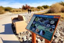
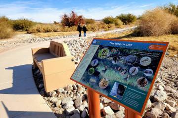
It’s best to take a look at a map before stepping onto the trail, but the many Late Night routes may remain confusing. There’s a very general map at the parking lot along with informational panels about the Old Spanish Trail, which runs through the area.
Late Night Trailhead gives you access to multiple easy and moderately challenging paths leading to gorgeous scenery — and abundant opportunity to lose your worries while possibly temporarily losing your way.