Natural bridges a monumental testament to the beauty of nature
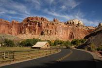
Natural Bridges National Monument isn’t the easiest park to get to, but the rewards are well worth your time. The drive really becomes one of them, for it wraps the traveler in some of the most spectacular scenery of the Southwest. And the monument’s location in the Four Corners section of Utah makes it practical to visit several other parks on the same trip: Capitol Reef National Park, Arches National Park, Monument Valley Navajo Tribal Park and Navajo National Monument are all in striking distance.
Preserving three of the most impressive natural stone bridges in the Southwest, and the public’s right to visit them, was the reason for establishing the national monument. Natural bridges, formed by water cutting through stone, are rarer than arches. While most arches are seen in the skyline, natural bridges form in deep canyons.
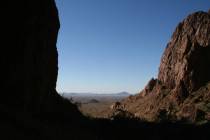
This park is on Cedar Mesa at an elevation of about 6,500 feet. Starting at the visitor center and following a paved, nine-mile scenic driving loop will give one access to viewpoints for each of the bridges in the canyon below. Each viewpoint is less than a five-minute walk from the parking area. For those who want adventure and a close-up gander at a bridge, there are trails down into the canyon. One version of this hike is a long loop that accesses all three.
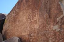
The bridges’ names all honor American Indians. Kachina Bridge is named for rock art designs found on the bridge that resemble emblems used on Kachina dolls. Owachomo means "rock mound," a natural feature on the bridge’s east side. Sipapu Bridge is named for a place from which the Hopi believe their ancestors entered this world; Sipapu means "Place of Emergence."
Sipapu Bridge is the second-largest natural bridge in the world; it spans 268 feet and is 220 feet high. The largest is Rainbow Bridge in Glen Canyon. While there is a great viewpoint to see this bridge, hiking down into the canyon adds an extra treat. It is a moderately strenuous round-trip hike of one and two-tenths miles, with an elevation gain of about 500 feet on the return.
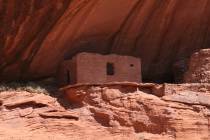
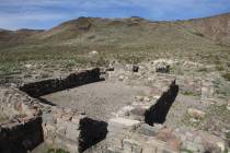
Your next stop along the loop drive might be the unpaved trail to see Horsecollar Ruin. It is named because the doorways to two structures look like horse collars. From the viewpoint you can look down into White Canyon and see the ancestral Puebloan cliff dwelling located in a deep alcove. A pair of binoculars really helps. There are two granaries and a kiva, the kind of room used for ceremonies and perhaps meetings. These ruins are thought to have been abandoned more than 700 years ago.
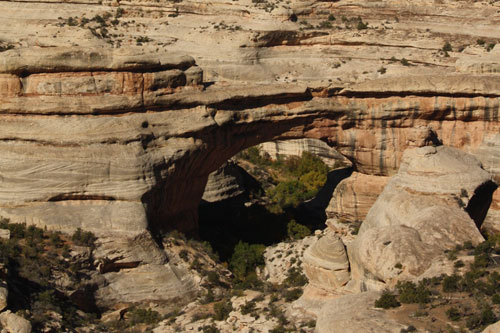
The Kachina Bridge overlook is next. This bridge spans 204 feet and is 210 feet high. You can get close to it with a hike of only 1.5 miles round trip, but there is a 400-foot elevation gain on the return. The terrain is uneven and steep in many places.
Owachomo Bridge is the final stop. Unless the sun is low in the sky, it’s hard to see from the viewpoint. But its access hike is easiest of the three bridges, less than a half-mile round trip with an elevation gain of 180 feet on the return. The bridge is 106 feet high and spans 180 feet.
All the overlook trails to view the natural bridges are wheelchair accessible via concrete walkways. But the Kachina Bridge viewpoint is steeper than others, so a person using a wheelchair or walker might have an easier time if a helper came along.
This is also a great place to view the night skies, for they are almost uncompromised by man-made light. The International Dark-Sky Association designated the monument as the world’s first International Dark Sky Park.
The park is open year-round, except major holidays. Operating hours at the visitor center are 8 a.m. to 5 p.m. from now through April and until 6 p.m. in the later months of longer days. Dress warmly, for the daily temperatures in November average in the 50s.
There are no services in the park, but they can be found in Blanding, Utah, about 35 miles away.
Deborah Wall is the author of "Great Hikes, A Cerca Country Guide" and "Base Camp Las Vegas: Hiking the Southwestern States," published by Stephens Press. She can be reached at deborabus@aol.com.