Deborah Wall: Here’s how to enjoy best of Bryce Canyon in summer

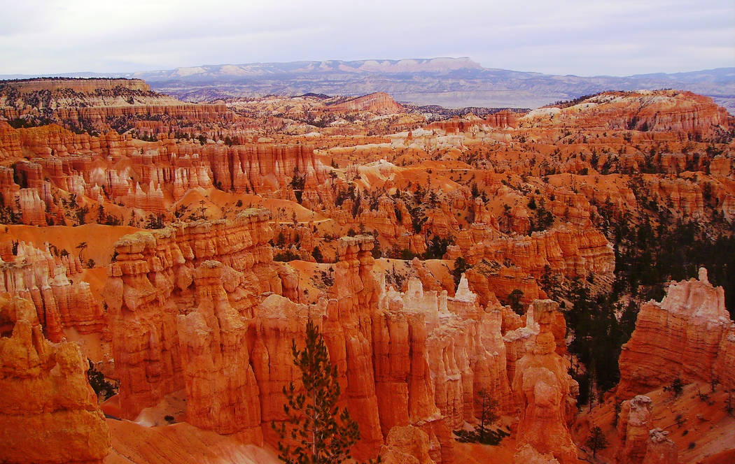
Bryce Canyon National Park in Utah is on everybody’s list of must-see places in the Southwest, but during summer, dealing with the crowds and traffic can be frustrating at best. However, if you have some flexibility in your schedule, there’s a remedy. Check out the park’s popular main area, with its natural amphitheaters filled with striking hoodoo formations, first thing in the morning, before most visitors arrive. Then set out to other areas of Bryce for hiking.
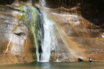
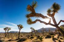
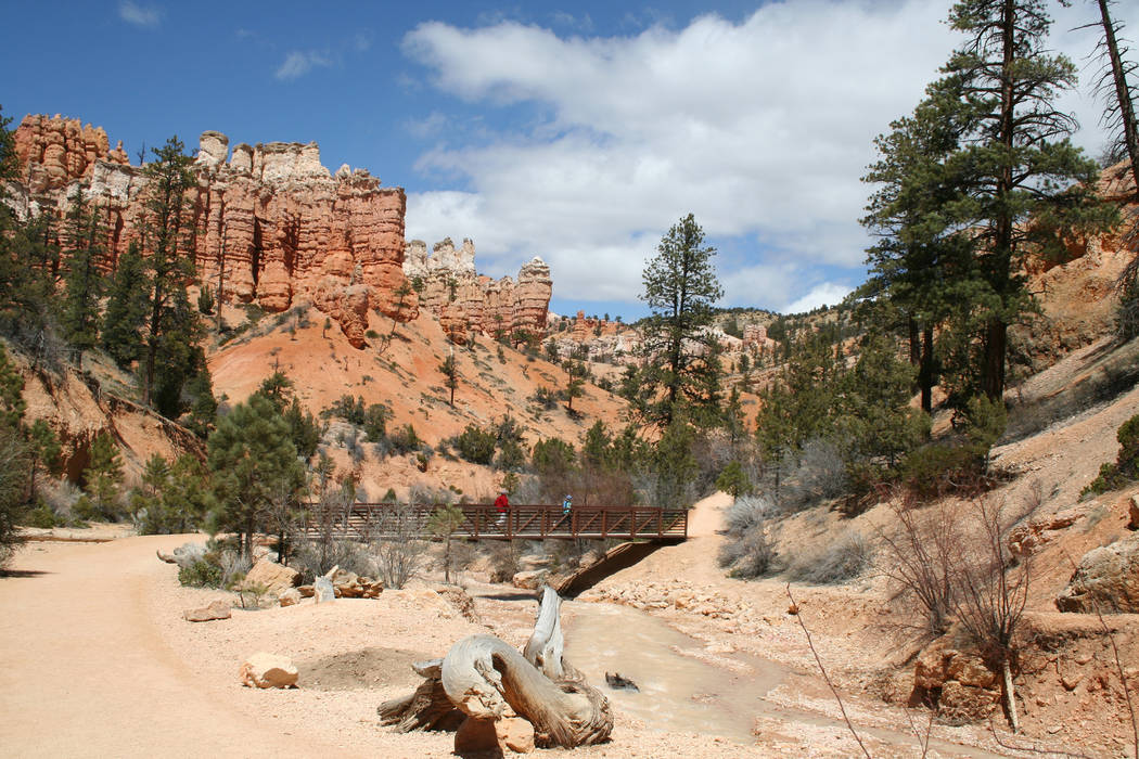
An especially good choice, outside the main corridor yet still within colorful scenery, is the Mossy Cave Trail in the northeastern area of the park. The trailhead is on Scenic Byway 12, about a 7-mile drive from Bryce’s main entrance. This path will lead you among some of the park’s signature hoodoos, past a small waterfall, to Mossy Cave itself, a spring-fed hollow dripping with water this time of year.
Expect daily high temperatures in the mid-80s with nighttime lows in the 50s in July and August. The trail begins at the parking area at an elevation of 6,805 feet. The 0.9-mile round-trip trail has about a 300-foot elevation gain. Because the elevation is so much higher than that of Las Vegas, the hike might seem tiring, especially if you arrived in the park that same day and are not acclimatized. The trail is not suitable for strollers, but most children 6 and older can handle it. However, be aware there are steep drop-offs in the upper reaches of the trail.
Well-marked, the trail starts through a pinyon-juniper woodland, with a few ponderosa pines here and there. You will begin to see more and more hoodoos, formed in the colorful pink, orange and red limestone. They are constantly changing shape and size from 200 cycles a year of snowmelt and expansion, freezing and thawing, which splits and flakes the rock. Rainfall also contributes by creating creeks and gullies on limestone walls, leaving “fins” of rock — relatively thin walls that erode away here and there, leaving free-standing and erratically shaped columns called hoodoos.
From the start of the trail you will be flanking the south side of Water Canyon and then walking over a footbridge to the other side. Continue and you will cross the drainage once again. Thereafter the trail forks, and exploring each direction will be worth it.
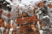
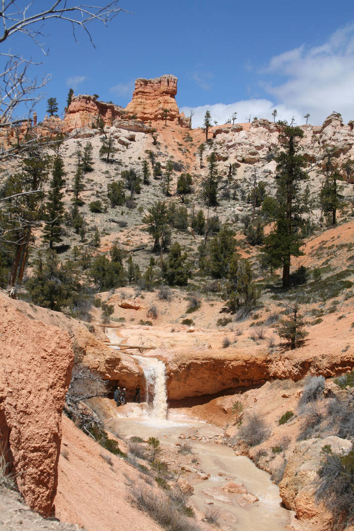
The left fork brings you up a short, yet steep, trail to Mossy Cave. Standing at the entrance you will be treated to refreshing cold air. In summer there will be some spring-fed water seeping down through small patches of moss, yet for most of the year the cave is full of ice. Resist the urge to go inside the cave, as the plant life is extremely fragile.
To explore the other fork, return to the junction and head north. Be careful, as there are high drop-offs and there often is severe erosion along the western bank. In just a few minutes you will find yourself at the top of a 15-foot waterfall. Except in extremely dry years there is usually a good flow from May to October. To get to the waterfall’s base you will have to backtrack and walk up the drainage itself, but that’s worth it if you want to cool yourself off.
Deborah Wall’s book “Base Camp Las Vegas: 101 hikes in the Southwest” ($24.95, Imbrifex) is available for preorder on Amazon and will be released Aug. 8. She can be reached at deborabus@aol.com.
Directions
To Bryce Canyon: From Las Vegas, take Interstate 15 north 125 miles, and take Exit 16 (Hurricane/Zion National Park and Utah Route 9). Follow Route 9 for 57 miles through Zion and turn left at Mount Carmel Junction onto U.S. 89. Go north 43 miles and turn right onto Utah Route 12. After 14 miles, turn right on Utah Route 63 and head 3 miles to the Bryce Canyon National Park Entrance.
To Mossy Cave from main entrance: Return 3 miles along Utah 63 to Byway 12. Go right, away from park, and follow for about 4 miles to parking area and trailhead on your right.