Cool down on Death Valley trail
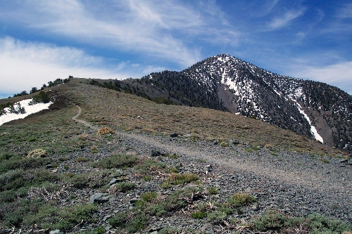
You might think summer outdoor activities in Death Valley National Park are out of the question, but this is actually an ideal time to hike to the summit of the park’s Panamint Mountains. The best bet is the maintained Telescope Peak Trail, which takes you to the highest elevation in the park at 11,049 feet.
The Mahogany Flat Campground serves as the trailhead. Because of its location, at an elevation of 8,133 feet, temperatures could be more than 40 degrees or so cooler than the valley below. As you hike higher in elevation, things will cool off even more, and summit temperatures might be in the high 60s or low 70s.
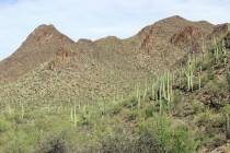
The hike starts off in a pinyon pine woodland, but as you gain elevation, the vegetation will get more sparse. This time of year you will find cliffrose in bloom and a wide variety of wildflowers, including lupine, red Indian paintbrush, both Panamint and Death Valley pentsemon, buckwheat and evening primrose.
Birds commonly seen along the trail include raven, Steller’s J ay, pinyon jay and Clark’s nutcracker, but you might also have the opportunity to see redtail hawk, mountain chickadee and the dark-eyed junco.
The first couple of miles are moderately strenuous as you will gain about 1,500 feet in elevation. The trail then levels off for about 1.5 miles through the Arcane Meadows area. Once you reach the four-mile mark, the trail descends for about one-half mile. Soon you will find ancient Bristlecone pines dotting the landscape. Although they appear windblown and tortured, these trees are extremely hardy, and some are 3,000 years old.
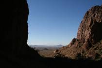
The final stretch to the summit is strenuous but well worth your efforts. The views are some of the best in the W est. To the northwest lies the Sierra Nevada, where you will see Mount Whitney, which at 14,494 feet is the highest point in the contiguous 48 United States. To the east, you can see Badwater Basin, where you will find the lowest point in the Western Hemisphere: 282 feet below sea level.
Since this is a strenuous 14-mile round-trip hike with a 2,916-foot elevation gain, many people choose to turn it into a backpacking trip. Camping is allowed on the trail, as long as you are at least two miles beyond the trailhead.
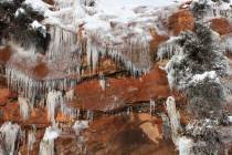
Since much of the hike is exposed, there aren’t too many choice spots, but it is quite pleasant in Arcane Meadows. Be sure to pick up a map and a free backcountry permit at the temporary Furnace Creek Visitor Center or the Stovepipe Wells Ranger Station. And keep in mind even in summer, the trail could still possibly have freezing temperatures — and even snow.
One of the biggest dangers of this hike is just driving to the trailhead. Sizzling temperatures and remote roads could turn this trip into a treacherous one if you are not prepared. It could be days before someone else comes along, and cell phones are unreliable in this area. The last 1.5 miles to the trailhead are very rough and slow going, and a high clearance vehicle with good off-road tires is a must. Be sure to have plenty of emergency supplies, and carry more water than you think you will ever need.
Deborah Wall is the author of “Great Hikes, A Cerca Country Guide” and “Base Camp Las Vegas: Hiking the Southwestern States,” published by Stephens Press. She can be reached at deborabus@aol.com.
DIRECTIONSFrom the Furnace Creek area, take California Route 190 west for about 33 miles, go left onto Emigrant Canyon Road for 21 miles and then left on Wildrose Canyon Road. Drive 8.6 miles to Mahogany Flat Campground and trailhead.