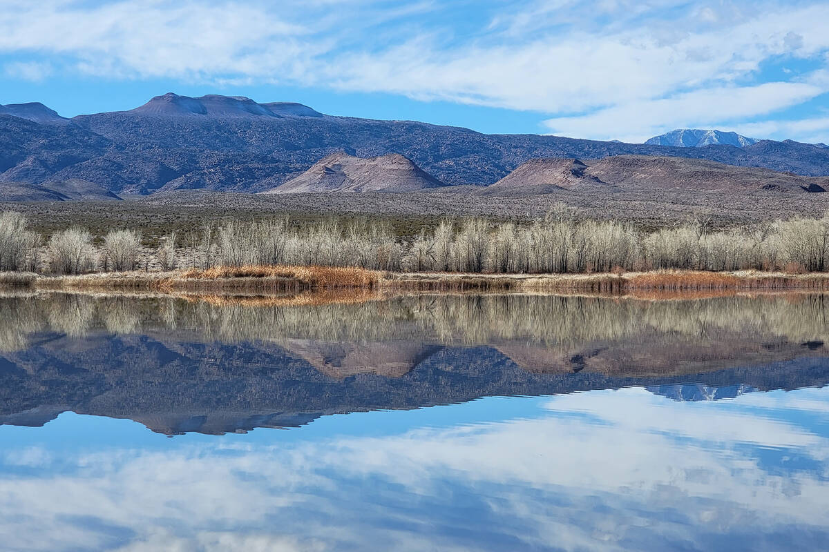
Explore a desert oasis 90 miles from Las Vegas

Pahranagat National Wildlife Refuge shines in every season, but winter offers visitors some of the prettiest and most peaceful walking of the year.
Located about 90 miles north of Las Vegas, the often placid Upper Pahranagat Lake is circled by a path where leafless trees along the shore weave an intricate latticework of branches that provide perches for occasional bald eagles and red-tailed hawks. When the sun is bright and winds are light, winter is also a good time to be on the moderately challenging Davenport Trail that leads hikers over desert hills between the upper lake and the refuge’s visitor center.
Shorter, easier paths wind around the visitor center and offer an introduction to a riparian habitat that has lured people and animals for thousands of years. Pahranagat means “valley of shining water” in the Paiute or Nuwuvi language.
The refuge’s 5,382 protected acres are a year-round desert oasis for wildlife and an important food-and-lodging stop for migratory birds as they navigate the Pacific Flyway. During fall and winter, thousands of ducks and geese make their home in these Lincoln County waters.
Hunting is allowed on the refuge in the lower Pahranagat Valley on Saturdays, Tuesdays and Thursdays. No hunting is allowed on Upper Pahranagat Lake or near the visitor center, but Sundays, Mondays, Wednesday and Fridays are still preferred days for hiking there.
Refuge visitors have several trail choices and can patch together shorter or longer paths to map a desirable mix of mileage and personal interest.
Davenport Trail
On a recent Sunday, we traveled U.S. Highway 93 north toward Alamo and looked for the sign that marks Pahranagat’s visitor center turnoff about 1½ hours from Las Vegas. Our plan was to leave our car parked at the visitor center for much of the day. Typically, we start refuge visits 3 miles farther up U.S. 93 at Upper Pahranagat Lake for a hike around the lake, but this time we wanted to start on the 1.7-mile Davenport Trail, which leads to the upper lake from the visitor center.
The trail begins near the visitor center’s parking lot with a sign that’s marked with the Davenport name and diamond shapes, which have been used by the Nuwuvi to symbolize and advocate respect for resources and traditions on their ancestral land. Rocks line the wide packed-dirt Davenport Trail as it winds through upland desert and past creosote, bursage, Joshua trees and various cactuses, including cholla and hedgehog. Flying overhead during separate points on our hike were a pair of red-tailed hawks and an immature bald eagle.
The trail’s gradual ascent intensified fairly quickly, but the work was worth the panoramic payoff. From hilltops on the Davenport Trail, it’s easy to see why the Nuwuvi called the area “valley of shining water.” Lake water can be seen shimmering in opposite directions in the lower and upper parts of the valley.
In winter, some of the only green comes from spiky clumps on Joshua trees, members of the agave family. Under the big sky of Nevada, browns, mauves and dark grays are dominant colors on the surrounding mountains, and layers of silver from cottonwood trees line Upper Pahranagat Lake’s shore. Golden marshland reeds and grasses near the shore mix with the landscape’s layers of burgundy from dried-up remains of flowering yerba mansa and of rust from spent desert trumpet plants.
The scenery is stunning along the Davenport Trail, which is named in honor of a pair of refuge volunteers.
Hiking options
Once Davenport hikers arrive at the upper lake’s shoreline, one option is to loop back to the visitor center along the Waterway Trail, which is a scenic part of a dirt road open only to authorized refuge vehicles. That option means about a 3-mile hike total. The second option is to step onto the Upper Lake Trail at the end of the Davenport Trail for what will amount to a 6-mile grand total by the time hikers return to the visitor center. Those who choose the longer route can return to the visitor center via the Waterway Trail or go back in the reverse direction on the Davenport Trail after completing the Upper Lake Trail.
Walking along the Upper Lake Trail gives visitors the greatest chances of seeing birds of prey on fishing expeditions and wintering ducks loafing in the water. Small mammals are also a possibility. If conditions are right, those walking across the lake’s dike will have a terrific vantage point to photograph remarkable reflections of surrounding mountains and shorelines. In December and January, visitors on this trail also have the best opportunities to see and hear wintering tundra swans on the lake.
After crossing the dike in the direction of the day-use picnic area, hikers will take a right to follow a dirt road that parallels the lake (part of the Upper Lake Trail) and pass several campsites. At the end of the line of campsites and close to public restrooms, the Waterway Trail begins. The trail parallels U.S. 93 for a little less than a mile before reaching a road and trails that approach the visitor center. As the name would suggest, Waterway Trail includes sights and sounds of a stream and the riparian habitat that helps support life in Pahranagat Valley.
The currently closed Black Canyon petroglyph area sits across U.S. 93 from the Waterway Trail. Scanning with binoculars from the Waterway Trail, visitors with help from afternoon sunlight, are able to spot petroglyphs, including those of Pahranagat Man and bighorn sheep.
The remaining weeks of February are a time to appreciate the stripped-down, simplified beauty of Pahranagat in winter before spring arrives to green up and energize the wildlife that call this desert oasis home.