Cooler months invite Southern Nevada hikers to explore

Hiking in the Mojave Desert recently switched from an infernal pursuit to an invigorating one. That’s what happens in the fall, when temperatures drop in Southern Nevada and the sun returns to its ways of warming rather than broiling.
Such change opens up opportunities to explore areas with heavy sun exposure like Valley of Fire and Sloan Canyon, which most daytime hikers avoid during the scorching months of June through September. Signs at Lake Mead and Valley of Fire discourage hikers from sun-scorched trails during those months because of the heat’s deadly intensity.
On those same trails now, the sun can be a friend on chilly fall mornings and cold winter afternoons. Three moderately challenging trails to add to any local must-hike list are Liberty Bell Trail in Lake Mead National Recreation Area; Petroglyph Canyon in Sloan Canyon National Conservation Area; and a Valley of Fire State Park combination of White Domes Loop and Fire Wave.
The trio’s highlights include a natural arch shaped like Philadelphia’s famous Liberty Bell; a surprising, sizable gallery of petroglyphs at Sloan Canyon; and a giant, walkable collection of sandstone stripes, swirls and layers at Valley of Fire.
Liberty Bell Trail
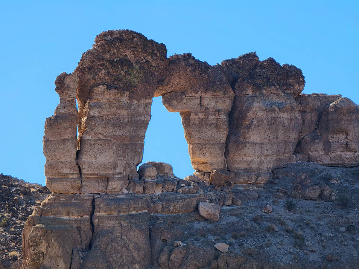
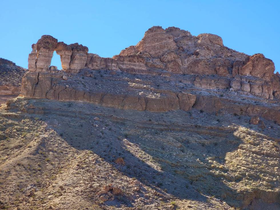
This hike in otherworldly terrain starts at the White Rock Canyon/Arizona Hot Springs parking lot south of Hoover Dam on the left side of U.S. Highway 93 en route to Kingman, Arizona, from Las Vegas. After parking, hikers head west under the highway and in the direction of the Black Mountains and Colorado River via a gravelly, sandy wash that includes canyon walls shaped by past flash flooding. About a mile in, hikers should look for a junction and take the option of heading higher up and to the right on a trail that meanders through hills in the direction of the Liberty Bell arch. If hikers continue along the wash, they will be on a more strenuous path to Arizona Hot Springs.
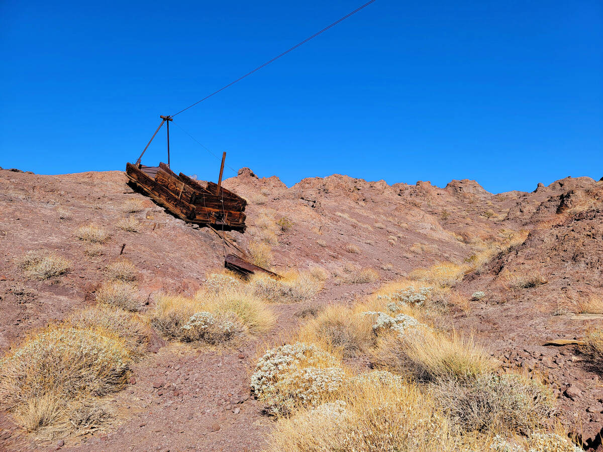
Abundant on the Liberty Bell Trail are panoramas of dramatic geology with sharp peaks, steep drops and colorful bands of mysterious rock. Abandoned along the Liberty Bell path are remnants of a World War II-era magnesium mine and its transport system. But the trail’s high point is the Liberty Bell arch at the top of a tall butte, which comes into view from the curvy and rocky trail and gets more impressive with each step. Past the arch, the 5.5 mile round-trip hike includes an option to look over the Black Canyon rim and spy the Lower Colorado River 1,000 feet below. (There’s no river access and no shade, so wear a hat and bring lots of water and snacks.) nps.gov/lake/learn/nature/liberty-bell-arch.htm
Petroglyph Canyon
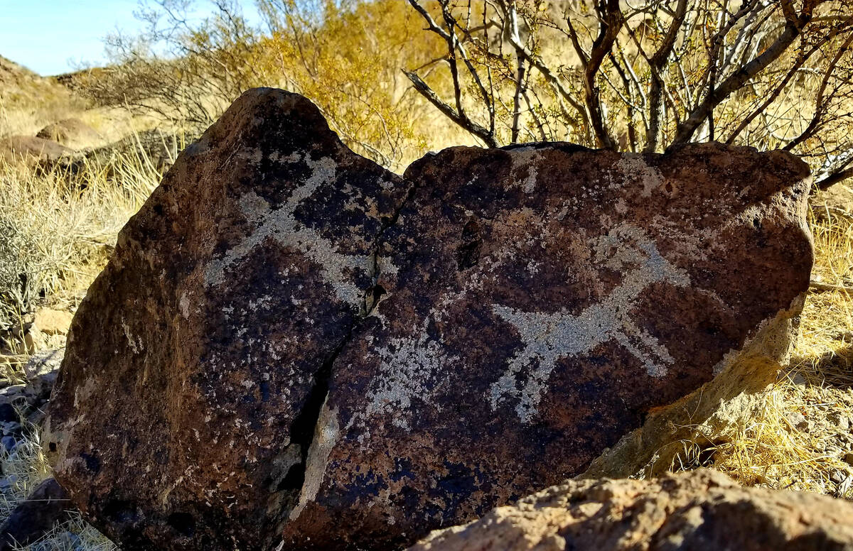
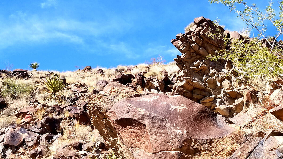
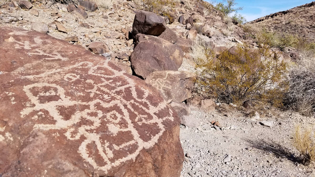
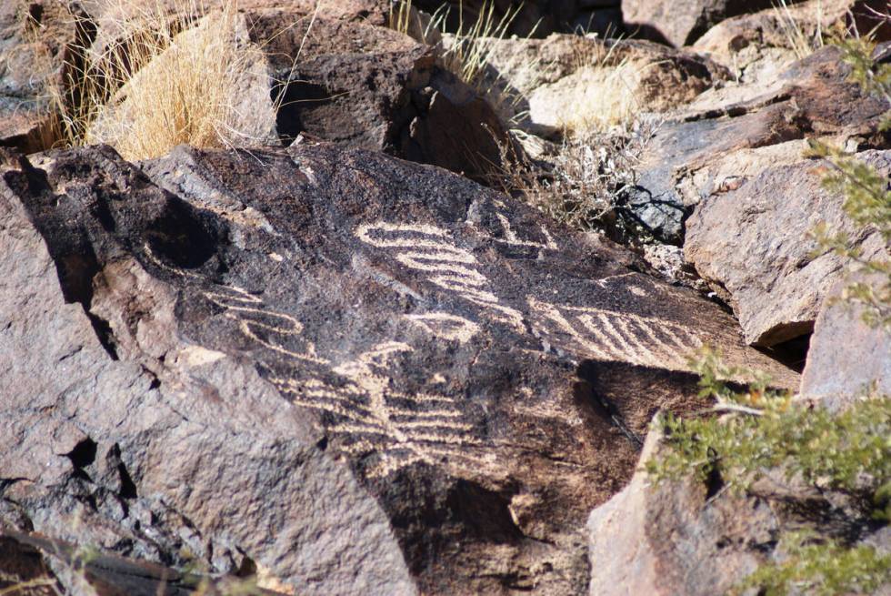
The McCullough mountain range towers over the far southern end of Las Vegas Valley development. Nearly 50,000 acres of the area’s scenery, geology, wildlife and cultural history are protected and managed as Sloan Canyon National Conservation Area by the Bureau of Land Management. Within those boundaries is Petroglyph Canyon, one of the most significant cultural sites in Southern Nevada because of its 300 rock art panels that feature 1,700 individual design elements created by Native Americans.
A moderately difficult 4-mile round-trip hike is the only way to see the site’s highest concentration of petroglyphs. Etched, chipped and pecked into the dark patina of the canyon’s volcanic rock are the gallery’s abstract swirls, squiggles, geometric patterns, whimsical figures and realistic representations. Dozens of petroglyphs are right along the trail, but some are far above the canyon’s floor, so binoculars come in handy.
The gallery includes obvious representations of bighorn sheep, but other images have more mystery than known meaning. Some 200-year-old petroglyphs with men on horseback might share space with images created thousands of years earlier in this longtime bighorn sheep hunting ground. They all tell stories that contribute to Southern Nevada’s human history.
The route to Petroglyph Canyon begins at Sloan Canyon visitor area, where checking in is a requirement, and its parking lot at 1000 Nawghaw Poa Road (meaning Mountain Sheep Trail in Paiute). A path through creosote bushes leads to the 100 Trail, a wide, gravelly, sandy wash. A little more than a grueling mile later, a junction in the path offers the option of the 200/Cowboy Trail on the right. That rocky and uphill ascent is a personal preference, but others like continuing along the wash and following the 100 Trail up and over dry waterfalls, rather than facing them on the descent back to the car. Leaving the wash at the junction, the 200 Trail is rocky, uphill and curvy en route to Petroglyph Canyon. Following that ascent, hikers head down to another section of the wash, but this time they are rewarded with hundreds of petroglyphs and an invitation to plop down and take a break to study rock art. Hikers can return the 200 Trail way they came or complete a partial loop and descend the dry waterfalls on the 100 Trail, which follows the wash and leads back to the parking lot. blm.gov/sloan-canyon-nca
Fire Wave and White Domes trails
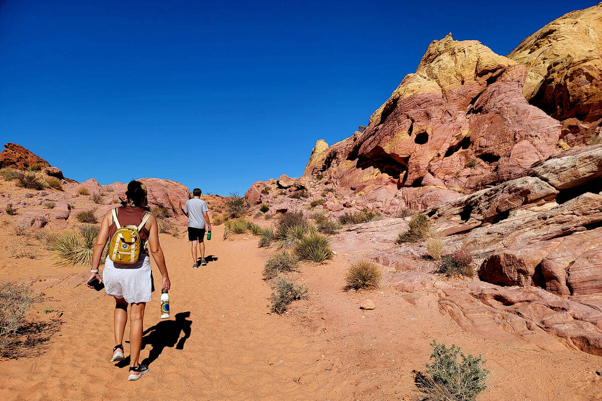
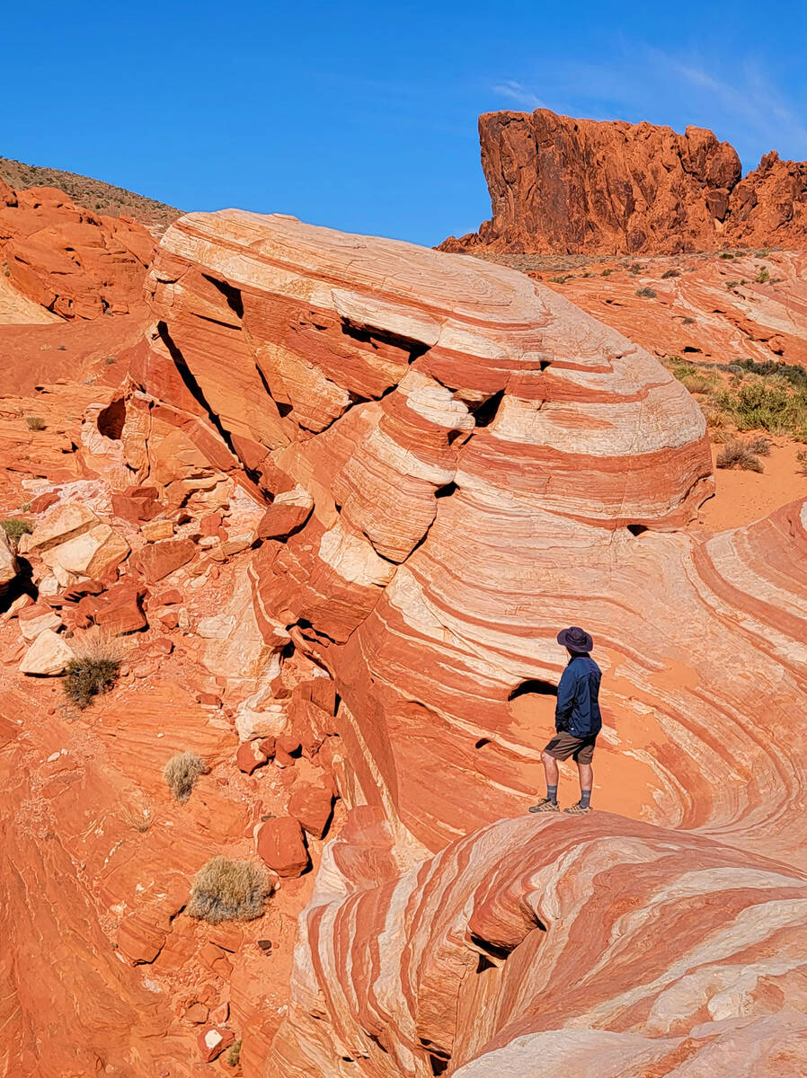
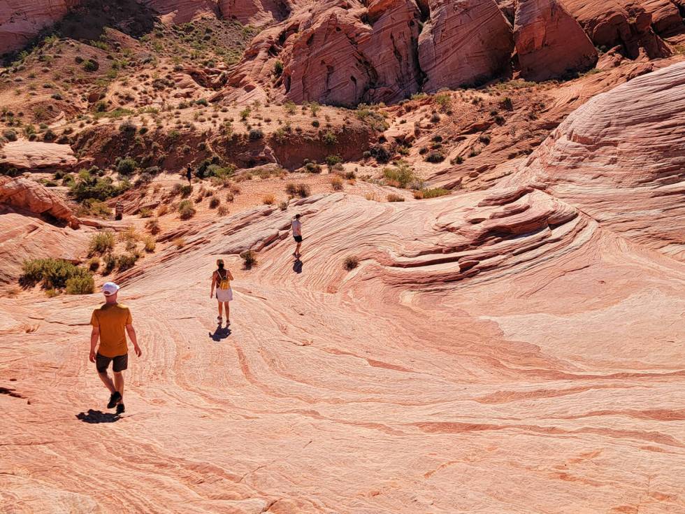
Valley of Fire State Park specializes in remarkable sandstone formations and spectacular rock patterns in burnt red, terra cotta, raspberry, peach, cream and gold mixed with a little light purple and mint green. Walks across and through the terrain in fall and winter give visitors enough inspiration to manage any workweek. The best spot to start the awe tour is at the much-photographed Fire Wave across from parking lot 3 on White Domes Road because this stop gets busy.
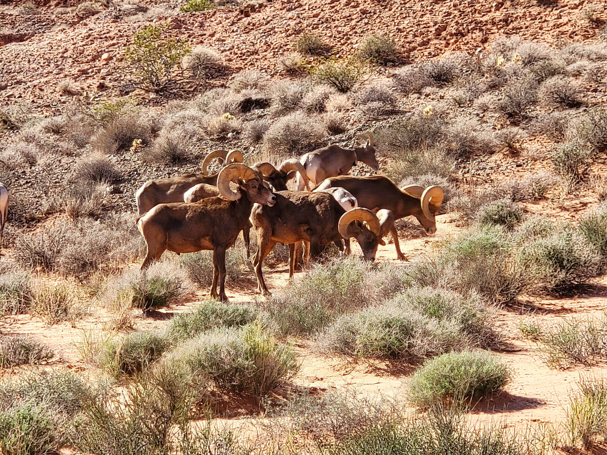
Arriving early is key. On a visit last month, we found limited parking at 10:30 a.m. After an hour at the Fire Wave (1.5-mile out-and-back hike with a lucky sighting of 20 bighorn sheep that day), we found a nearly full parking lot at the end of White Domes Road for our second stop at the popular 1.1-mile loop trail. Both hikes are moderately challenging because of their occasional rocky and steep conditions.
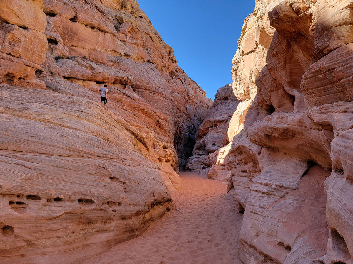
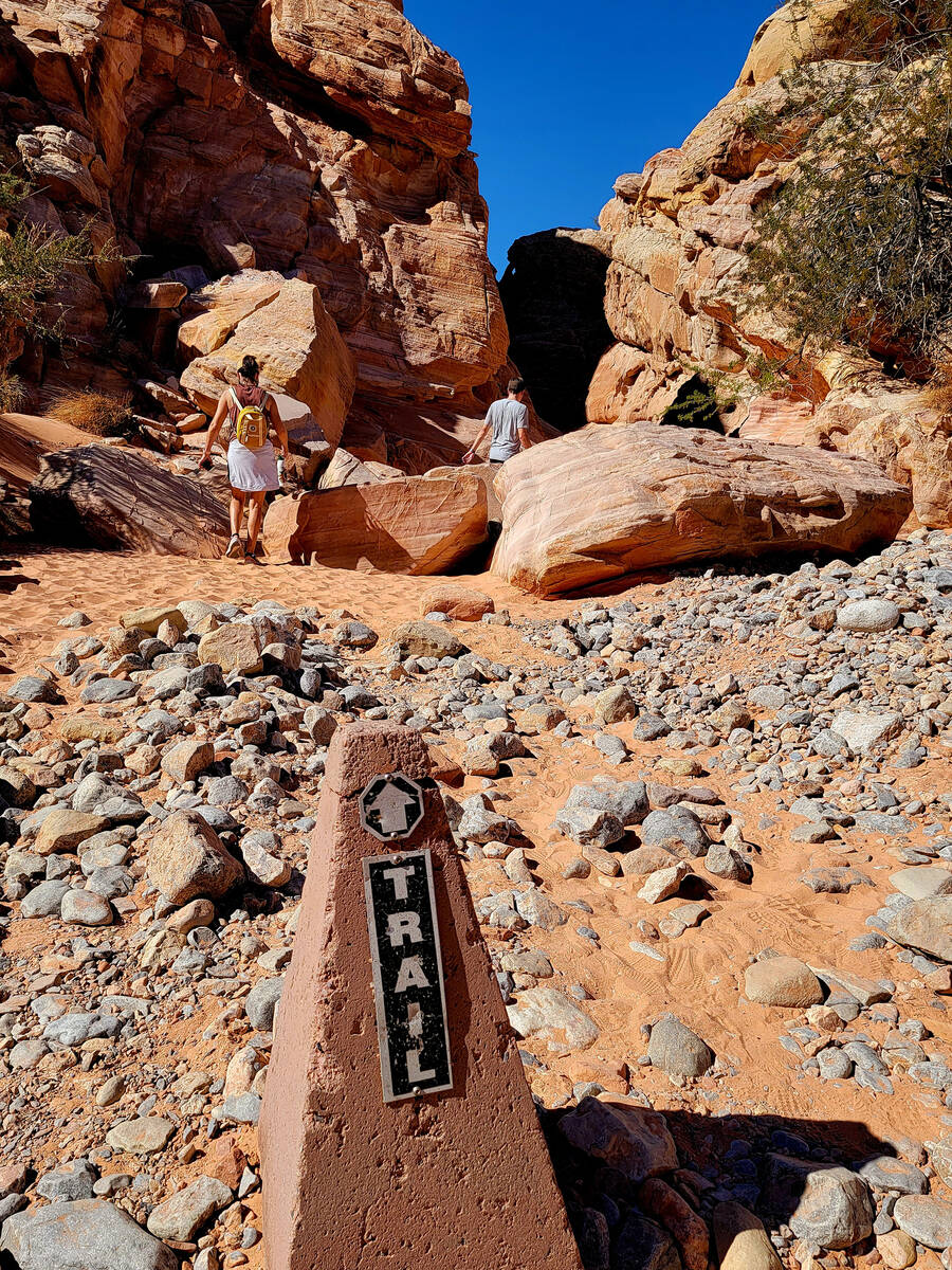
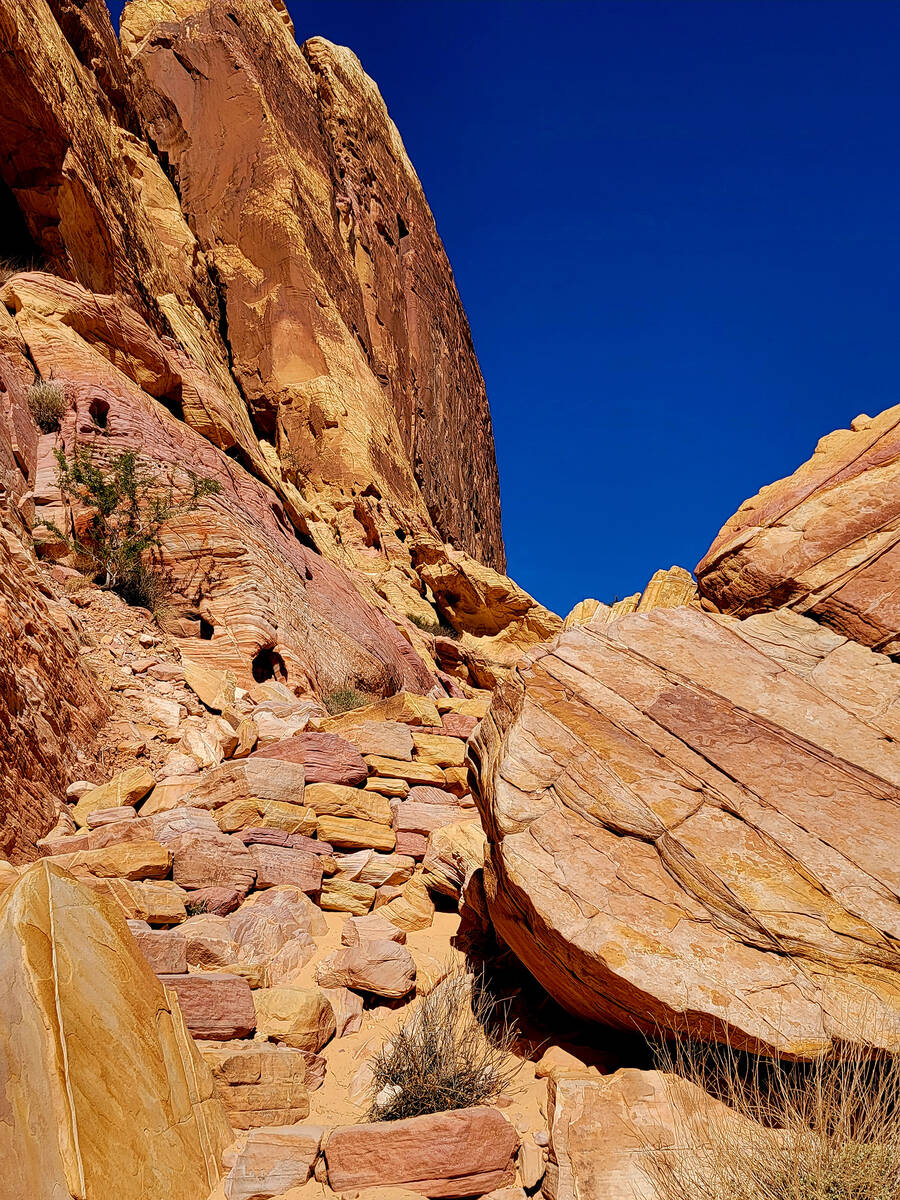
White Domes Loop is a hike with a little bit of everything — soft beach-like sand, a steep set of rock stairs, colorful canyon walls, remnants from a movie set, a narrow slot canyon, sandstone windows, small caves and boundless beauty.
Valley of Fire State Park is about 50 miles northeast of Las Vegas. Entrance is $10 for vehicles with Nevada license plates ($15 for others). parks.nv.gov/parks/valley-of-fire