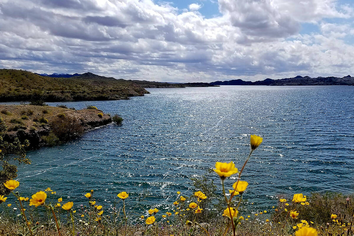
A wildflower-powered workout 90 minutes south of Las Vegas

Uncommon wildflowers should be part of the spring hiking mix in the coming weeks at Lake Mohave, a boon for anyone looking to accent their workout with desert blooms.
Barbie-pink sand verbena and striking desert ajo lilies make a home in the dunes near the end of a 90-minute drive south from Las Vegas to Katherine Landing, a marina within Lake Mead National Recreation Area on the Arizona side of the Lower Colorado River. Those same spring flowers aren’t found along hiking trails closer to home in Southern Nevada at spots such as Red Rock Canyon National Conservation Area.
In the latter half of March, ajo lilies typically bloom in dunes near Lake Mohave’s South Arizona Telephone Cove, which is found on National Park Service maps. They are tall, elegant Sonoran Desert flowers. The southern boundary of the expansive Lake Mead National Recreation Area flirts with the northern end of the Sonoran Desert. The area’s sandy conditions, lower elevations and rainfall levels make ideal conditions for the lilies, sand verbena and dune primrose. These unusual wildflower suspects can mix with more predictable ones such as purple phacelia and golden suncups on hikes at Lake Mohave.
How bountiful this year’s blooms will be in Northern Arizona and Southern Nevada deserts remains a secret, but late February offered a few signs. “I am still hoping that will happen, but I haven’t seen a whole lot of emerging plants to ensure that this happens,” Carrie Norman, a vegetation biologist at Lake Mead National Recreation Area, said of this spring’s flower scene. “There are a few spots I have seen that have that blanket green look, which is promising for a wildflower display. But that is definitely not everywhere.”
Roadside wildflowers are sometimes the best wildflowers, so adding a pleasant drive to Princess Cove for lake views and potential flower power should be a Lake Mohave must after any hike.
The National Park Service lists two unmaintained hikes for the Katherine Landing area of Lake Mohave: Lake View Trail and Fisherman’s Trail. The area, also home to Davis Dam, is near Bullhead City and Laughlin. Desert, hills, sand dunes, whimsical rock formations and protected coves make up the landscape. Panoramas from the trails include the impressive peaks of wilderness areas that parallel the Colorado River.
Lake View Trail
This trail is a moderate 4.7-mile round-trip hike that begins at the west end of parking lot B at Katherine Landing. Trail parking is available in the lot next to the day-use picnic area. Lake View Trail, which at the start offers views of the harbor, ends at South Arizona Telephone Cove, the hike’s turnaround point. There, hikers will find a couple of covered picnic tables, limited shade, bathrooms, lake views, a beach, mountain panoramas, sand-loving wildflowers and usually a couple of visitors who have arrived by car rather than on foot to enjoy the beach, views and wildflowers.
At times, Lake View Trail’s dirt path is faint and a bit confusing, but the ultimate goal is to keep moving north from Katherine Landing and arrive at a wide beach that is part of South Arizona Telephone Cove, which is marked as a dog-free zone. Along the trail during the second half of March and into April, hikers can typically expect to see Mojave Desert flowers including desert marigolds, brittlebush, phacelia, creosote and chia, along with sand verbena, dune primrose and ajo lilies.
No matter how brilliant the 2024 wildflower season turns out to be, Lake Mohave spring hikers can get a good workout while enjoying pretty mountain and lake views that always show up.
Fisherman’s Trail
While Lake View Trail leads north from Katherine Landing, the easy 1.8-mile round-trip Fisherman’s Trail follows the southern outline of the harbor toward Davis Dam. Fisherman’s Trail starts southeast of Katherine Landing’s launch ramp. Parking is available near the boat rental and repair shop. Along the trail to the beach, the park service recommends stopping at an impressive sand dune to look for the tracks of critters including bugs, lizards, birds and mammals. After stands and clumps of mesquite trees and arrow weed bushes, the trail ends at Ski Cove’s sandy beach, a popular spot for picnicking, fishing and swimming when the weather warms.
On the way to Lake Mohave
The quickest route to Katherine Landing is via Interstate 11, which bypasses Boulder City, and then south on U.S. Highway 93. Along U.S. 93, motorists should look out for a turnoff to Willow Beach about 15 miles south of Hoover Dam. If this spring’s desert bloom proves brilliant, mid-March wildflower power is likely to be strong along that National Park Service road down to the boat launch and picnic area.
Last March, roadside wildflower displays were stunning there. Ajo lilies don’t grow along that road leading to the Colorado River, but you may find abundant fuschia Bigelow’s monkey flowers, suncups, lupines, brittlebush, pincushions, poppies, phacelia, golden desert snapdragons and desert chicory. Impressive wildflower displays were also enjoyed last year in March and April in the general areas of Oatman and Kingman. Blooms were abundant in Southern Nevada, as well.
Hiking and kayaking
Even though temperatures are cooler in the spring, desert hiking still demands that visitors carry an adequate supply of water, plenty of snacks, sunscreen and common sense. Heat kills, and that’s why the National Park Service institutes seasonal closures of Lake Mead’s strenuous and exposed hikes from mid-May through September.
Willow Beach and Katherine Landing marinas offer an extra exercise option: kayaking. Personal watercraft rentals are available at both locations, and reservation information is found on links on Lake Mead National Recreation Area’s searchable website (nps.gov/lake/index.htm). It also has information on Lake Mead and Lake Mohave area hikes, as well as the plants and animals making their homes in the 1.5 million acres of mountains, canyons, valleys and waters.